Category:2004 maps of the United States
Jump to navigation
Jump to search
Countries of the Americas: Canada · United States of America
States of the United States: Alabama · Arizona · California · Georgia · Massachusetts · New York · Pennsylvania · South Carolina · Utah
Subcategories
This category has the following 11 subcategories, out of 11 total.
A
- 2004 maps of Arizona (1 F)
C
G
M
- 2004 maps of Massachusetts (6 F)
N
P
S
- 2004 maps of South Carolina (8 F)
U
- 2004 maps of Utah (3 F)
W
- WPDMS maps (215 F)
Media in category "2004 maps of the United States"
The following 5 files are in this category, out of 5 total.
-
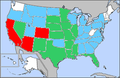
 2004 august west nile map.png 280 × 183; 31 KB
-
 2004 july west nile map.png 280 × 183; 31 KB
-
 2004 october west nile map.png 280 × 183; 31 KB
-
 2004 september west nile map.png 280 × 183; 32 KB
-
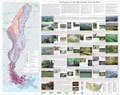 Mississippi Alluvial Plain Level IV ecoregions.pdf 6,652 × 5,260; 9.19 MB


