Category:2000 United States Census TIGER maps
Jump to navigation
Jump to search
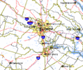
English: Maps generated by the United States Census using TIGER data for the 2000 United States Census. These maps are generally updated every 10 years.
Subcategories
This category has the following 2 subcategories, out of 2 total.
Media in category "2000 United States Census TIGER maps"
The following 3 files are in this category, out of 3 total.
-
Ada Covered Bridge TIGER map.png 422 × 359; 15 KB
-
Mount Wilson California Map.PNG 431 × 367; 21 KB
-
Richmond-Petersburg TIGER MAP.gif 422 × 359; 18 KB


