Category:1 Opolska Street in Tarnowskie Góry
Jump to navigation
Jump to search
| Object location | | View all coordinates using: OpenStreetMap |
|---|
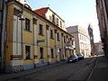
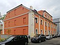
Polski: Tarnowskie Góry, dom, XVI, XIX w.
house in Tarnowskie Góry, Silesian Voivodeship, Poland   | |||||
| Upload media | |||||
| Instance of | |||||
|---|---|---|---|---|---|
| Location | Tarnowskie Góry, Tarnowskie Góry county, Silesian Voivodeship, Poland | ||||
| Street address |
| ||||
| Architectural style | |||||
| Heritage designation |
| ||||
| Inception |
| ||||
 | |||||
Media in category "1 Opolska Street in Tarnowskie Góry"
The following 15 files are in this category, out of 15 total.
-
 Kościół Zbawiciela w Tarn. Górach od ul. Opolskiej 02.jpg 3,003 × 4,003; 5.61 MB
-
 Opolska 1 (Tarnowskie Góry).JPG 2,304 × 1,728; 1.51 MB
-
 Tarnowitz Ringecke 02 (Alfred Adolph).jpg 1,615 × 1,021; 724 KB
-
 Tarnowskie Góry - dom, ul. Opolska 1 01 (wnętrze - interior).jpg 3,037 × 4,049; 9.37 MB
-
 Tarnowskie Góry - Opolska 1.jpg 4,000 × 2,927; 5.59 MB
-
 Tarnowskie Góry, dom, XVI, XIX w. 01.JPG 4,608 × 3,456; 3.45 MB
-
 Tarnowskie Góry, dom, XVI, XIX w. 02.JPG 4,608 × 3,456; 3.46 MB
-
 Tarnowskie Góry, dom, XVI, XIX w. 03.JPG 3,456 × 2,592; 3.16 MB
-
 Tarnowskie Góry, dom, XVI, XIX w. 04.JPG 3,456 × 2,592; 3.28 MB
-
 Tarnowskie Góry, Opolska 1.jpg 3,888 × 2,592; 3.25 MB
-
 Tarnowskie Góry, ul. Opolska 1 (02).jpg 3,808 × 2,661; 5.73 MB
-
 Tarnowskie Góry, ul. Opolska 1 2022 01.jpg 3,789 × 2,842; 5.74 MB
-
 Tarnowskie Góry, ul. Opolska 1 2022 02.jpg 3,702 × 2,777; 5.27 MB
-
 Tarnowskie Góry, ul. Opolska 1 2022 03.jpg 2,976 × 2,368; 4.98 MB
-
 Tarnowskie Góry, ul. Opolska 1.jpg 3,886 × 2,914; 3.21 MB

.JPG)
.jpg)
.jpg)


.jpg)

