Category:1 Świętego Krzyża street in Kraków
Jump to navigation
Jump to search
| Object location | | View all coordinates using: OpenStreetMap |
|---|
.JPG) | |||||
| Upload media | |||||
| Instance of | |||||
|---|---|---|---|---|---|
| Location | Kraków, Lesser Poland Voivodeship, Poland | ||||
| Street address |
| ||||
| Heritage designation |
| ||||
| Inception |
| ||||
 | |||||
| Address |
|
Media in category "1 Świętego Krzyża street in Kraków"
The following 9 files are in this category, out of 9 total.
-
 Kamienica-UlicaŚw.Krzyża1-POL, Kraków.jpg 6,000 × 3,800; 7.85 MB
-
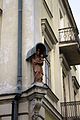
 Krakow kamienica Sw Krzyza 1 detal.jpg 667 × 2,723; 1.12 MB
-
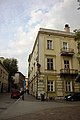
 Kraków, św. Krzyża 1 (1).JPG 3,168 × 4,752; 4.76 MB
-
 Kraków, św. Krzyża 1 (2).JPG 4,752 × 3,168; 4.86 MB
-
 Kraków, św. Krzyża 1 (3).JPG 3,168 × 4,752; 5.03 MB
-
 Kraków, św. Krzyża 1 (4).JPG 3,168 × 4,752; 5.22 MB
-
 Kraków, św. Krzyża 1 (5).JPG 4,752 × 3,168; 5.75 MB
-
 Kraków, św. Krzyża 1 (6).JPG 3,168 × 4,752; 5.27 MB
-
 Kraków, św. Krzyża 1.JPG 3,168 × 4,752; 4.32 MB

.JPG)
.JPG)
.JPG)
.JPG)
.JPG)
