Category:19th-century maps of the Spanish Empire
Jump to navigation
Jump to search
Subcategories
This category has the following 6 subcategories, out of 6 total.
1
- 19th-century maps of Hispaniola (21 F)
C
Media in category "19th-century maps of the Spanish Empire"
The following 13 files are in this category, out of 13 total.
-
 1807 Cary Map of South America - Geographicus - SouthAmerica-cary-1807.jpg 3,400 × 6,000; 6.19 MB
-
 1815 Thomson Map of Cuba. Bermuda ^ the Bahamas - Geographicus - Cuba-t-1816.jpg 3,500 × 2,993; 2.07 MB
-
 1818 Pinkerton Map of South America - Geographicus - SouthAmerica-pinkerton-1818.jpg 3,603 × 5,000; 4.82 MB
-
 T.V.(1857) - (10) MAPA DE LAS ISLAS FILIPINAS Y MARIANAS.jpg 3,201 × 2,169; 1.61 MB
-
-
 Atlas de Filipinas.djvu 3,653 × 4,198, 57 pages; 5.79 MB
-
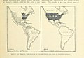
 Carte de l'Empire Espagnol dans les deux Ameriques, 1873.jpg 4,100 × 5,650; 4.05 MB
-
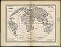 España 1864.jpg 2,021 × 1,550; 417 KB
-
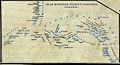
 Hispanoasia 1.JPG 1,781 × 812; 393 KB
-
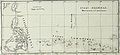
 Islas Marianas Palaos y Carolinas.JPG 902 × 489; 184 KB
-
 Mapa ilustrado del Reino de España y sus posesiones para la Guardia Civil.jpg 8,173 × 6,316; 38.66 MB
-

-
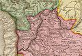 Pinkerton-1812-AltoPeru.jpg 967 × 667; 760 KB


_-_(10)_MAPA_DE_LAS_ISLAS_FILIPINAS_Y_MARIANAS.jpg)
.jpg)


_(14781958802).jpg)
