Category:19th-century maps of the Gambia
Jump to navigation
Jump to search
Countries of Africa: Algeria · Angola · Benin · Botswana · Cameroon · Cape Verde · Chad · Democratic Republic of the Congo · Republic of the Congo · Djibouti · Egypt‡ · Equatorial Guinea · Eritrea · Eswatini · Ethiopia · Gabon · The Gambia · Ghana · Guinea · Guinea-Bissau · Ivory Coast · Kenya · Lesotho · Liberia · Libya · Madagascar · Mali · Mauritania · Morocco · Mozambique · Namibia · Niger · Nigeria · Senegal · Sierra Leone · Somalia · South Africa · South Sudan · Sudan · Tanzania · Togo · Tunisia · Uganda · Zambia · Zimbabwe
Other areas: Canary Islands · Madeira · Western Sahara
‡: partly located in Africa
Other areas: Canary Islands · Madeira · Western Sahara
‡: partly located in Africa
Media in category "19th-century maps of the Gambia"
The following 17 files are in this category, out of 17 total.
-
 109 of 'Les Artères du globe ... Illustré de ... gravures et cartes' (11197636046).jpg 1,707 × 1,571; 610 KB
-

-

-
 Africa (1878) (14753269636).jpg 3,584 × 1,784; 1.34 MB
-

-

-
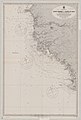 Admiralty Chart No 1147 Africa west coast Cape Verde to Cape St Ann, Published 1900.jpg 8,397 × 12,439; 10.26 MB
-
 Admiralty Chart No 594 Africa west coast River Gambia to Cape Lopez and Anno Bom, Published 1885.jpg 12,439 × 8,287; 14.14 MB
-
 Admiralty Chart No 599 Cape Verde to Cape Roxo, Published 1830.jpg 5,995 × 8,064; 8.78 MB
-
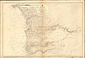 Admiralty Chart No 599 Cape Verde to River Cacheo, Published 1896.jpg 16,415 × 11,285; 45.86 MB
-
 Africa (1878) (Senegal, Gambia, Sierra Leone etc.).jpg 1,783 × 2,641; 735 KB
-
 Andree96-1.jpg 1,990 × 2,535; 4.79 MB
-

-
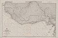
 Meyer‘s Zeitungsatlas 101 – Senegambien (West-Africa).jpg 7,455 × 6,224; 14.1 MB
-
 Sedhiu1.jpg 4,136 × 2,100; 4.15 MB
-
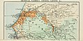
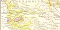
 Senegambia 1881 map sz498.jpg 498 × 634; 368 KB
-
 West Africa 1839 Mitchell map - Kong.jpg 1,020 × 680; 206 KB
.jpg)


_(14753269636).jpg)
.jpg)
.jpg)


_(Senegal,_Gambia,_Sierra_Leone_etc.).jpg)


.jpg)


