Category:19th-century maps of Saint-Dié-des-Vosges
Jump to navigation
Jump to search
Media in category "19th-century maps of Saint-Dié-des-Vosges"
The following 4 files are in this category, out of 4 total.
-

-

-
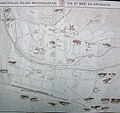 Map of Saint-Dié (Vosges) in 1896.jpg 2,000 × 1,883; 2.46 MB
-
 Saint-Dié, ses environs et quelques parties des Vosges - btv1b10223209n.jpg 3,082 × 3,637; 2.29 MB
_(3).jpg)
.jpg)
_in_1896.jpg)
