Category:19th-century maps of Moravia
Jump to navigation
Jump to search
Subcategories
This category has the following 2 subcategories, out of 2 total.
I
M
Media in category "19th-century maps of Moravia"
The following 19 files are in this category, out of 19 total.
-

-
 1850 Perthes Map of Bohemia ( Czech Republic ) - Geographicus - Boheme-perthes-1850.jpg 4,000 × 3,304; 3.58 MB
-
 1853 Mitchell Map of Germany - Geographicus - Germany-mitchell-1850.jpg 2,389 × 3,000; 2.54 MB
-
 Atlas over alle Jordens Dele - no-nb digibok 2010021603001-15.jpg 3,214 × 3,080; 1.91 MB
-
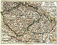
 1862 Perthes Map of Bohemia and Austria - Geographicus - DeutschlandSE-perthes-1862.jpg 3,036 × 2,551; 2.27 MB
-
 Historická mapa - Čechy a Morava za zřízení župního ve XII století.jpg 2,758 × 2,291; 1.31 MB
-

-
 Meyers leiner Hand-atlas 1893 (73136732).jpg 9,560 × 6,396; 12.13 MB
-
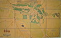 Bucovice map y-1860.jpg 2,540 × 1,609; 3.82 MB
-
 Bučovice 1820.JPG 2,540 × 1,609; 3.68 MB
-

-

-
 Kořistkova mapa moravského a slezského průmyslu 1860.gif 1,000 × 759; 448 KB
-
 Mapa Scharditzka.jpg 600 × 673; 221 KB
-
 Meyers b3 s0134a.jpg 2,048 × 1,586; 1.01 MB
-
 Morava.1897.jpeg 2,175 × 1,632; 1.83 MB
-
 Mořkov, Schenklova mapa krajů.jpg 865 × 537; 120 KB
-
 Schoberova mapa Moravy a Slezska (1888).jpg 2,540 × 2,004; 1.02 MB
-
 Atlas de l'histoire du Consulat et de l'Empire 1859 (135883791).jpg 11,378 × 7,415; 52.02 MB

_-_Geographicus_-_Boheme-perthes-1850.jpg)


%27_(11174838534).jpg)
.jpg)


.jpg)


.jpg)
.jpg)