Category:1999 in North Yorkshire
Jump to navigation
Jump to search
Ceremonial counties of England: Bedfordshire · Berkshire · Buckinghamshire · Cambridgeshire · Cheshire · Cornwall · Cumbria · Derbyshire · Devon · Dorset · Durham · East Riding of Yorkshire · East Sussex · Essex · Gloucestershire · Greater London · Greater Manchester · Hampshire · Herefordshire · Hertfordshire · Isle of Wight · Kent · Lancashire · Leicestershire · Lincolnshire · Merseyside · Norfolk · North Yorkshire · Northamptonshire · Northumberland · Nottinghamshire · Oxfordshire · Rutland · Shropshire · Somerset · South Yorkshire · Staffordshire · Suffolk · Surrey · Tyne and Wear · Warwickshire · West Midlands · West Sussex · West Yorkshire · Wiltshire · Worcestershire
City-counties: Bristol · City of London
Former historic counties:
Other former counties:
City-counties: Bristol · City of London
Former historic counties:
Other former counties:
Subcategories
This category has the following 10 subcategories, out of 10 total.
Media in category "1999 in North Yorkshire"
The following 54 files are in this category, out of 54 total.
-
 850 feet and rising - geograph.org.uk - 220507.jpg 640 × 464; 57 KB
-
 Above Sutton Bank - geograph.org.uk - 582677.jpg 640 × 415; 87 KB
-
 Big Wood near Osmotherley - geograph.org.uk - 355686.jpg 447 × 640; 86 KB
-
 Bolton Castle - geograph.org.uk - 952032.jpg 640 × 438; 62 KB
-
 Brimham Rocks - geograph.org.uk - 954759.jpg 640 × 436; 89 KB
-
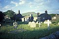 Churchyard, Horton In Ribblesdale.jpg 640 × 422; 81 KB
-
 Coxwold - geograph.org.uk - 124929.jpg 550 × 391; 32 KB
-

-
 EastWitton.jpg 640 × 465; 82 KB
-
 Footbridge at Bainbridge - geograph.org.uk - 924956.jpg 640 × 480; 199 KB
-
 Fountains Abbey - geograph.org.uk - 103294.jpg 640 × 427; 119 KB
-
 Golden Lion, Osmotherley - geograph.org.uk - 582721.jpg 640 × 449; 103 KB
-
 Gordale Scar - geograph.org.uk - 2484.jpg 330 × 400; 31 KB
-
 Hardraw Force in Wintertime - geograph.org.uk - 139538.jpg 429 × 640; 72 KB
-
 Hawes Main Car Park - geograph.org.uk - 144927.jpg 640 × 314; 51 KB
-
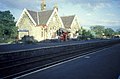 Horton-in-Ribblesdale station - geograph.org.uk - 27642.jpg 640 × 419; 71 KB
-
 How Stean Gorge - geograph.org.uk - 1448179.jpg 471 × 640; 150 KB
-
 Hummersea National Trust land - geograph.org.uk - 585445.jpg 640 × 408; 57 KB
-
 Ingleton Pecca Falls - geograph.org.uk - 139536.jpg 640 × 423; 69 KB
-
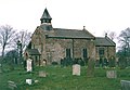 Liverton Church - geograph.org.uk - 67273.jpg 640 × 443; 117 KB
-
 Northern edge of Grass Wood - geograph.org.uk - 1154611.jpg 640 × 480; 334 KB
-
 Rock outcrop, Roundell's Allotment - geograph.org.uk - 1435569.jpg 640 × 483; 189 KB
-
 Rocks at summit of Great Whernside - geograph.org.uk - 194045.jpg 640 × 431; 54 KB
-
 Scotton Weir, River Nidd, Yorkshire - geograph.org.uk - 813066.jpg 640 × 401; 75 KB
-
 Sink holes, Pen-y-Ghent Gill - geograph.org.uk - 1517601.jpg 518 × 640; 419 KB
-
 Staithes Beck - geograph.org.uk - 585465.jpg 640 × 434; 95 KB
-
 The Moorcock Inn - Langdale End - geograph.org.uk - 1607526.jpg 640 × 457; 90 KB
-
 The Moorcock Inn - Langdale End - geograph.org.uk - 1607692.jpg 640 × 456; 87 KB
-
 Thornton Force in Wintertime - geograph.org.uk - 139533.jpg 640 × 438; 88 KB
-
 Track to Simon's Seat - geograph.org.uk - 92305.jpg 412 × 640; 104 KB
-
 Walled garden - geograph.org.uk - 199149.jpg 640 × 360; 67 KB
-
 Causeway, Burtersett - geograph.org.uk - 247971.jpg 640 × 486; 80 KB
-
 Chapel - le - Dale in Winter - geograph.org.uk - 139541.jpg 640 × 421; 100 KB
-
 Crookrise - geograph.org.uk - 34927.jpg 404 × 640; 63 KB
-
 Dalehouse, Staithes - geograph.org.uk - 67268.jpg 640 × 439; 165 KB
-
 Esk and Railway - geograph.org.uk - 41884.jpg 640 × 480; 60 KB
-
 Gateway - geograph.org.uk - 29837.jpg 640 × 480; 140 KB
-
 Green Haw, Wharfedale - geograph.org.uk - 123609.jpg 395 × 552; 43 KB
-
 Hawes - geograph.org.uk - 17831.jpg 640 × 480; 49 KB
-
 Height Laithe above Threshfield - geograph.org.uk - 194480.jpg 640 × 509; 68 KB
-
 High Faggergill - geograph.org.uk - 34925.jpg 640 × 401; 52 KB
-
 Hill Stones, Kettleness, Barnby - geograph.org.uk - 67259.jpg 640 × 434; 106 KB
-
 Kettle Ness, Barnby - geograph.org.uk - 67261.jpg 640 × 438; 136 KB
-
 Landslip country, Barnby - geograph.org.uk - 67252.jpg 640 × 386; 115 KB
-
 Langthwaite. - geograph.org.uk - 34926.jpg 439 × 640; 81 KB
-
 Looking towards Malham Cove - geograph.org.uk - 2478.jpg 480 × 315; 32 KB
-
 Mell Close - geograph.org.uk - 34922.jpg 640 × 410; 67 KB
-
 Nunnington village - geograph.org.uk - 124917.jpg 393 × 553; 44 KB
-
 Path in winter - geograph.org.uk - 199144.jpg 639 × 458; 41 KB
-
 Private service reservoir - geograph.org.uk - 199134.jpg 640 × 435; 49 KB
-
 Runswick Bay - geograph.org.uk - 67246.jpg 640 × 435; 106 KB
-
 Trow Gill - geograph.org.uk - 139540.jpg 640 × 424; 107 KB
-
 Whaw - geograph.org.uk - 34919.jpg 640 × 456; 81 KB
-
 Yealand Woods - geograph.org.uk - 34918.jpg 640 × 415; 103 KB


