Category:1950s maps of Belgium
Jump to navigation
Jump to search
Countries of Europe: Albania · Austria · Belgium · Bulgaria · Denmark · Estonia · Finland · France‡ · Georgia‡ · Germany · Greece · Hungary · Iceland · Republic of Ireland · Italy · Lithuania · Luxembourg · Netherlands‡ · Norway · Poland · Portugal‡ · Romania · Russia‡ · Spain‡ · Sweden · Switzerland · Turkey‡ · Ukraine · United Kingdom
Limited recognition: Abkhazia‡
‡: partly located in Europe
Limited recognition: Abkhazia‡
‡: partly located in Europe
Media in category "1950s maps of Belgium"
This category contains only the following file.
-
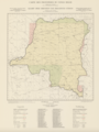 Carte des frontières du Congo belge.png 1,044 × 1,392; 2.25 MB
