Category:1930s maps of the world
Jump to navigation
Jump to search
| 20th-century maps of the world: ← 1900s 1910s 1920s 1930s 1940s 1950s 1960s 1970s 1980s 1990s → |
English: This category is supposed to hold world maps created in the 1930s.
For later created maps showing the history of that decade, see Category:Maps of the world in the 1930s
For later created maps showing the history of that decade, see Category:Maps of the world in the 1930s
Subcategories
This category has the following 8 subcategories, out of 8 total.
- 1930 maps of the world (5 F)
- 1933 maps of the world (2 F)
- 1934 maps of the world (1 F)
- 1935 maps of the world (3 F)
- 1937 maps of the world (8 F)
- 1938 maps of the world (6 F)
- 1939 maps of the world (8 F)
Media in category "1930s maps of the world"
The following 14 files are in this category, out of 14 total.
-
 Domaine colonial de la France et ses productions - dressé par J. Forest... - btv1b53065328b.jpg 15,427 × 12,226; 27.39 MB
-
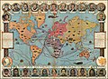
 McCormick's Map of the World.jpg 10,831 × 9,591; 24.58 MB
-
 France & Mappemonde - 4 cartes sur la même planche - btv1b53066669x (4 of 5).jpg 3,784 × 3,241; 2.23 MB
-
 Nouveau Planisphere Officiel L'Empire Colonial Francais et les Possessions Colonales des Nations.jpg 13,864 × 19,934; 70.05 MB
-
 Cassell’s Children’s Book of Knowledge Wonder Map of the World.jpg 16,560 × 11,958; 87.36 MB
-
 Colonial empire of France, 1931.jpg 2,072 × 1,275; 859 KB
-
 Crivelli World Map.png 4,000 × 3,055; 33.61 MB
-
 Lange diercke sachsen deutschtum erde.jpg 2,553 × 1,213; 1.91 MB
-
 Lange diercke sachsen erdkarten deutschlands welthandel.jpg 4,704 × 2,036; 3.28 MB
-
 McCormick's Map of the World - verso.jpg 9,621 × 10,849; 22.07 MB
-
 Mercator map of the world.tif 11,733 × 8,537; 286.6 MB
-
 PhilipsRadio1930s.jpg 949 × 689; 257 KB
-
 The New World and the European colonial system, 1823 and 1931.jpg 2,354 × 2,723; 616 KB
-
 Världskarta (ur Svensk världstlas).jpg 3,566 × 2,632; 2.18 MB


.jpg)


.jpg)