Category:1926 maps of Canada
Jump to navigation
Jump to search
Countries of North America: Canada · Mexico · United States of America‡
‡: partly located in North America
‡: partly located in North America
| ← 1920 1921 1922 1923 1924 1926 1927 1928 1929 → |
English: Maps of Canada from 1926 or related to Canada in 1926
Français : Les cartes du Canada de 1926 ou se rapportant au Canada en 1926
Media in category "1926 maps of Canada"
The following 4 files are in this category, out of 4 total.
-
 1926 Canada-Alaska 1903 boundary-map.jpg 448 × 432; 55 KB
-
 1926 Canada-Alaska 1903 boundary-map.png 429 × 418; 433 KB
-
 Canada 1926 Federal Election.svg 1,084 × 920; 452 KB
-
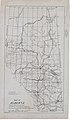 Map of Alberta showing areas with petroleum possibilities, that are being prospected.jpg 4,462 × 7,629; 7.33 MB


