Category:1920 maps of the United States
Jump to navigation
Jump to search
Countries of Oceania: New Zealand
States of the United States: California · Idaho · Illinois · Indiana · Iowa · Louisiana · Maryland · Massachusetts · Minnesota · Missouri · New Jersey · New Mexico · New York · Oklahoma · Pennsylvania · Texas · Vermont · West Virginia · Wisconsin · Wyoming – Washington, D.C.
Subcategories
This category has the following 23 subcategories, out of 23 total.
C
D
I
L
- 1920 maps of Louisiana (2 F)
M
- 1920 maps of Massachusetts (1 F)
- 1920 maps of Minnesota (1 F)
N
- 1920 maps of New Mexico (2 F)
O
P
T
- 1920 maps of Texas (1 F)
V
W
- 1920 maps of West Virginia (1 F)
Media in category "1920 maps of the United States"
The following 22 files are in this category, out of 22 total.
-

-

-
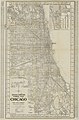 1920 Chicago map by Fred Wild.jpg 7,568 × 11,473; 13.99 MB
-
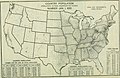
 1920 Electrical world NELA Geographic Divisions.png 1,436 × 966; 1,007 KB
-
 1920 Madison Wisconsin Automobile Blue Book.jpg 913 × 821; 187 KB
-
 1920 map Jacksonville, Florida Automobile Blue Book.jpg 658 × 609; 131 KB
-
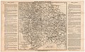
 1920 Map of the Connecticut Company System and Connections.jpg 14,458 × 10,608; 17.26 MB
-
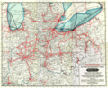 1920 Midwest interurban map.png 7,250 × 5,931; 14.44 MB
-
 1920 Milwaukee Wisconsin Automobile Blue Book.jpg 883 × 818; 251 KB
-
 Aero view of Port Jervis, New York 1920. LOC gm71005356.jpg 10,432 × 7,648; 14.21 MB
-
 Atlas of Ida County, Iowa LOC 2008626947-18.jpg 6,796 × 4,612; 7.89 MB
-
 Austin TX 1920 map.jpg 690 × 562; 128 KB
-
-
 Cedar River Watershed land ownership map, 1920 (51897543771).jpg 3,040 × 1,620; 869 KB
-

-
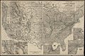
 Map of Activities of the Air Service - DPLA - 7a1843ab8b2681471f65b1c6a4791891.jpg 14,454 × 10,200; 13.61 MB
-
 Map of Army Corps Areas - DPLA - 7181635a105eb1e1605704653399749b.jpg 5,692 × 3,887; 809 KB
-
 Map of the vicinity of Richmond, Va. and part of the Peninsula LOC lva0000169.jpg 8,358 × 5,120; 7.61 MB
-

-
-
 United States relief map - btv1b53195468k.jpg 9,324 × 6,168; 7.48 MB
-
 Yearbook of agriculture (1921) (14771187034).jpg 2,656 × 1,734; 1.06 MB
._LOC_88690523.jpg)


.jpg)
.jpg)


.jpg)
.jpg)

_(14771187034).jpg)