Category:1920 maps
Jump to navigation
Jump to search
| ← · 1920 · 1921 · 1922 · 1923 · 1924 · 1925 · 1926 · 1927 · 1928 · 1929 · → |
Deutsch: Karten mit Bezug zum Jahr 1920
English: Maps related to the year 1920
Español: Mapas relativos al año 1920
Français : Cartes concernant l’an 1920
Русский: Карты 1920 года
Subcategories
This category has the following 11 subcategories, out of 11 total.
*
- 1920 maps of the world (9 F)
1
- 1920 maps of New Zealand (2 F)
A
C
- Comment finit la guerre (13 F)
E
G
N
O
S
Media in category "1920 maps"
The following 135 files are in this category, out of 135 total.
-
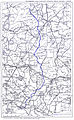
 1920 Hagen, Wanderkarte.jpg 1,175 × 778; 597 KB
-
 FYFE(1920) Map.jpg 1,536 × 1,719; 2.42 MB
-
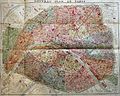
 1920 Robelin Map of Paris, France - Geographicus - Paris-robelin-1920.jpg 5,000 × 3,749; 14.88 MB
-
 1920 Vaux Monmouth Race Course.png 1,581 × 856; 766 KB
-
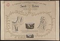 A chronological chart of the Jewish Kingdom 01-map (FL49973424 4073144).jpg 8,281 × 5,647; 52.6 MB
-
 A chronological chart of the Jewish Kingdom 02-verso (FL49973425 4073144).jpg 8,302 × 5,649; 61.88 MB
-
 A map of Fairyland - (imaginary locality) LOC 92680975.jpg 15,062 × 7,177; 17.51 MB
-
 Abhandlungen der Senckenbergischen Naturforschenden Gesellschaft (1920) (16578011759).jpg 4,702 × 2,950; 1.89 MB
-
 Abhandlungen der Senckenbergischen Naturforschenden Gesellschaft (1920) (16738273626).jpg 3,090 × 3,338; 4.18 MB
-
 Aero view of Port Jervis, New York 1920. LOC gm71005356.tif 10,432 × 7,648; 228.26 MB
-
 Alaska Road Commission 1920 map.jpg 1,000 × 827; 227 KB
-

-

-

-
 Atlas de l'Indochine dressé (...)Indochine française bpt6k11001779 67.jpg 8,040 × 5,752; 6.06 MB
-
 Atlas de l'Indochine dressé (...)Indochine française bpt6k11001779 70.jpg 5,555 × 8,448; 5.95 MB
-
 Atlas de l'Indochine dressé (...)Indochine française bpt6k11001779 73.jpg 5,840 × 8,515; 18.28 MB
-
 Atlas de l'Indochine dressé (...)Indochine française bpt6k11001779 76.jpg 8,383 × 5,926; 17.78 MB
-
 Atlas de l'Indochine dressé (...)Indochine française bpt6k11001779 79.jpg 5,758 × 8,623; 8.73 MB
-
 Bedford, Frederick George Denham, Bay of Haifa or Khaifa (FL6878249 2369482).jpg 2,877 × 2,170; 2.15 MB
-
-

-
 Blank map of Europe in 1920.svg 841 × 732; 541 KB
-

-

-
 Bulletin du Muséum d'histoire naturelle (1920) (19819246473).jpg 3,376 × 2,430; 1.64 MB
-
 Carte de la Géorgie - échelle 1-3.000.000 LOC 2017586276.jpg 4,671 × 3,413; 2.81 MB
-
 Carte de la Géorgie - échelle 1-3.000.000 LOC 2017586276.tif 4,671 × 3,413; 45.61 MB
-
 Central America & Panamá. LOC 2012586814.jpg 7,535 × 5,843; 7.8 MB
-
 Central America & Panamá. LOC 2012586814.tif 7,535 × 5,843; 125.96 MB
-
 City of Derby, Connecticut 1920.jpg 4,000 × 3,089; 3.42 MB
-
 City of Derby, Connecticut. LOC 73694677.jpg 6,464 × 4,992; 5.21 MB
-
 City of Derby, Connecticut. LOC 73694677.tif 6,464 × 4,992; 92.32 MB
-
 City of Manila, Philippine Islands LOC 2012586258.tif 8,429 × 11,203; 270.17 MB
-
 CUENCA DEL MEDITERRÁNEO. MAPA FÍSICO (MITTELMEERLANDER ).jpg 1,296 × 808; 810 KB
-
 Ebbets Field. LOC 78696099.jpg 2,522 × 3,191; 853 KB
-
 Ebbets Field. LOC 78696099.tif 2,522 × 3,191; 23.02 MB
-
 Erewani hatakagitsě 1920 tʻ. LOC 2012586642.jpg 12,988 × 9,539; 14.17 MB
-
 Erewani hatakagitsě 1920 tʻ. LOC 2012586642.tif 12,988 × 9,539; 354.46 MB
-
 Fatu Hiva 1920 nautical chart.jpg 4,574 × 3,843; 3.5 MB
-
 Free map and guide to Washington - seeing Washington right LOC 87693438.jpg 9,587 × 8,186; 13.38 MB
-
 Free map and guide to Washington - seeing Washington right LOC 87693438.tif 9,587 × 8,186; 224.53 MB
-
 French Service géographique de l'armée, Haiffa (FL25567992 2369470).jpg 13,338 × 12,521; 234.84 MB
-
 General map of Cairo. LOC 2009580102.jpg 15,416 × 11,579; 21.27 MB
-

-

-
 George Philip & Son, Iran (Persia) and Iraq (FL155698545 3718138).jpg 19,230 × 13,074; 269.16 MB
-

-

-

-

-
-
 Hanoi1920.jpg 1,503 × 1,194; 412 KB
-
 Hindenburg Line Map SGW Vol VIII.jpeg 1,200 × 789; 192 KB
-
 Inner Harbor Canal LOC 89697258.jpg 4,455 × 8,952; 10.22 MB
-
 Inner Harbor Canal LOC 89697258.tif 4,455 × 8,952; 114.1 MB
-
 Istanbul tram map 1920.jpg 1,280 × 895; 197 KB
-
 Kiessling Grosser Verkehrs-Plan von Berlin 1920.jpg 10,832 × 8,672; 35.13 MB
-
 Latv Kriev karte.jpg 1,081 × 1,754; 1.86 MB
-

-
 Macclesfield Bank 1920 nautical chart.jpg 4,456 × 3,444; 1.72 MB
-
 Map of Europe in 1920, after the Paris Peace Conference.jpg 2,996 × 2,185; 3.43 MB
-
 Map of Maryland showing the natural resources of the counties LOC 2009575051.jpg 4,782 × 2,874; 2.21 MB
-
 Map of Newton Mass. (3720085063).jpg 1,011 × 1,024; 842 KB
-
 Map of the battlefield of Shiloh. LOC 99448457.jpg 6,682 × 9,790; 11.46 MB
-
 Map of the battlefield of Shiloh. LOC 99448457.tif 6,682 × 9,790; 187.16 MB
-
 Map of the city of Lynn (9138252158).jpg 609 × 800; 136 KB
-
 Mideast1920 cropped.JPG 885 × 745; 215 KB
-
 Mideast1920.jpg 3,992 × 3,012; 2.48 MB
-
 Mongolian Operations 1920 (german).jpg 2,000 × 1,649; 2.42 MB
-
 Mount Stuart Square 1920.jpg 497 × 424; 88 KB
-
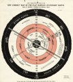
 New correct map of the flat surface, stationary earth (8252012521).jpg 880 × 2,000; 1.58 MB
-
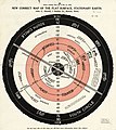 New correct map of the flat surface, stationary earth LOC 2013585077.jpg 4,440 × 4,986; 2.84 MB
-
 New correct map of the flat surface, stationary earth LOC 2013585077.tif 4,440 × 4,986; 63.34 MB
-
 Nimrud plan 1920.png 627 × 780; 501 KB
-
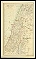 Palestine (FL83894141 2370235).jpg 2,994 × 4,811; 13.27 MB
-
 Paris metro 192x.jpg 3,537 × 2,825; 4.04 MB
-
 Pharus-asemakaava Helsinki.jpg 4,744 × 6,304; 21.6 MB
-
 Plan de Pnom-Penh. LOC map50000857.jpg 8,500 × 9,354; 11.01 MB
-
 Plan de Pnom-Penh. LOC map50000857.tif 8,500 × 9,354; 227.48 MB
-
 Planta da Chácara Encosto - 1, Acervo do Museu Paulista da USP.jpg 7,216 × 5,412; 13.84 MB
-
 Planta da Chácara Encosto - 2, Acervo do Museu Paulista da USP.jpg 7,216 × 5,412; 13.48 MB
-
 Planta da Divisão Judicial do Sítio Juca Padre - 1, Acervo do Museu Paulista da USP.jpg 7,216 × 5,412; 16.34 MB
-
 Planta da Divisão Judicial do Sítio Juca Padre - 2, Acervo do Museu Paulista da USP.jpg 7,216 × 5,412; 15.88 MB
-
 Planta da Fazenda do Barreiro - 1, Acervo do Museu Paulista da USP.jpg 7,216 × 5,412; 21.52 MB
-
 Planta da Fazenda Macauba - 1, Acervo do Museu Paulista da USP.jpg 5,412 × 7,216; 18.2 MB
-
 Planta do Sítio do Morro - 1, Acervo do Museu Paulista da USP.jpg 5,412 × 7,216; 20.62 MB
-
 Port Said (FL167448670 2370047).jpg 12,213 × 16,336; 194.61 MB
-
 Puerto Rico Natural Resources map 1920.png 5,048 × 3,210; 26.87 MB
-
 Qatarmap1920.jpg 494 × 306; 53 KB
-

-
 Rand McNally new official railroad map of the United States and southern Canada. LOC 2006627698.jpg 11,841 × 8,718; 16.63 MB
-
 Rand McNally new official railroad map of the United States and southern Canada. LOC 2006627698.tif 11,841 × 8,718; 295.34 MB
-
-
 Rand McNally official 1920 auto trails map, New York City and vicinity. LOC 88695915.jpg 5,980 × 7,673; 7.52 MB
-
 Rand McNally official 1920 auto trails map, New York City and vicinity. LOC 88695915.tif 5,980 × 7,673; 131.28 MB
-

-

-

-
 Route from Washington, D.C. to Old Pohick Church, Accotink, Virginia. LOC 90680885.jpg 2,998 × 5,334; 2.37 MB
-
 Route from Washington, D.C. to Old Pohick Church, Accotink, Virginia. LOC 90680885.tif 2,998 × 5,334; 45.75 MB
-

-

-
 Russian-Caucas-Front-1916.jpg 611 × 576; 158 KB
-
 SevresOttoman1927.JPG 1,392 × 992; 439 KB
-
 Spezialkarte der Österreichisch-ungarischen Monarchie - Bischoflack und Idria 1920.jpg 13,251 × 10,136; 33.6 MB
-

-

-
 The American journal of science (1920) (18153703905).jpg 2,108 × 3,416; 2.13 MB
-
 Topografische Kaart van Suriname (1916-1920) - Blad VII a6.jpg 5,070 × 5,500; 890 KB
-
 Topografische Kaart van Suriname (1916-1920) - Blad VII b6.jpg 5,047 × 5,500; 990 KB
-
 Topografische Kaart van Suriname (1916-1920) - Blad VII c5.jpg 5,094 × 5,500; 1.18 MB
-
 Topografische Kaart van Suriname (1916-1920) - Blad VII c6.jpg 5,079 × 5,500; 1.19 MB
-
 Topografische Kaart van Suriname (1916-1920) - Blad VII c7.jpg 5,052 × 5,500; 1.33 MB
-
 Topografische Kaart van Suriname (1916-1920) - Blad VII d4.jpg 5,046 × 5,500; 1.41 MB
-
 Topografische Kaart van Suriname (1916-1920) - Blad VII d5.jpg 5,012 × 5,500; 1.91 MB
-
 Topografische Kaart van Suriname (1916-1920) - Blad VII e4.jpg 5,079 × 5,500; 1.31 MB
-
 Topografische Kaart van Suriname (1916-1920) - Blad VII e5.jpg 5,035 × 5,500; 1.7 MB
-
 Topografische Kaart van Suriname (1916-1920) - Blad VII e6.jpg 5,069 × 5,500; 1.59 MB
-
 Topografische Kaart van Suriname (1916-1920) - Blad VII f5.jpg 5,062 × 5,500; 1.78 MB
-
 Topografische Kaart van Suriname (1916-1920) - Blad VII f6.jpg 5,057 × 5,500; 1.16 MB
-
 Topografische Kaart van Suriname (1916-1920) - Blad VII f7.jpg 5,106 × 5,500; 1.34 MB
-
 Topografische Kaart van Suriname (1916-1920) - Blad VII g8.jpg 5,124 × 5,500; 1.55 MB
-
 Topografische Kaart van Suriname (1916-1920) - Voorblad.jpg 5,124 × 5,500; 943 KB
-

-

-
 Washington and vicinity, Maryland, District of Columbia, Virginia. LOC 87695627.jpg 10,880 × 12,562; 14.98 MB
-
 Zara-Zadar 1920.jpg 1,056 × 1,638; 1.14 MB
-
 Zöology; a textbook for colleges and universities (1920) (14593523918).jpg 2,432 × 1,368; 263 KB
-
 Державні кольонії України.jpg 1,168 × 1,095; 1.57 MB
-
 Зангезурский Уезд 1920 год.png 679 × 700; 1 MB
-
 Палестина. Въ Настоящее Время (FL36566948 3914696).jpg 9,578 × 12,088; 166.49 MB
-
 מפת ארץ ישראל (FL49973419 4073131).jpg 12,966 × 16,482; 309.05 MB
-
 מפת גדוד העבודה עש יוסף טרומפלדור (FL79605894 3739988).jpg 2,309 × 4,095; 9.19 MB
-
 סביבות ירושלים (FL6880390 2367523).jpg 2,150 × 2,912; 2.2 MB

_Map.jpg)


.jpg)
.jpg)
_LOC_92680975.jpg)
_(16578011759).jpg)
_(16738273626).jpg)

Indochine_fran%C3%A7aise_bpt6k11001779_67.jpg)
Indochine_fran%C3%A7aise_bpt6k11001779_70.jpg)
Indochine_fran%C3%A7aise_bpt6k11001779_73.jpg)
Indochine_fran%C3%A7aise_bpt6k11001779_76.jpg)
Indochine_fran%C3%A7aise_bpt6k11001779_79.jpg)
.jpg)


_(19819246473).jpg)


.jpg)


.jpg)


_and_Iraq_(FL155698545_3718138).jpg)
_(14596205268).jpg)
_(14596340497).jpg)
_(14802705783).jpg)
,_Environs_of_Jerusalem_(FL25570441_2579357).jpg)
,_Syria_Jerusalem_and_Rafa_(FL4542043_2707442).jpg)


.jpg)

.jpg)


.jpg)

.jpg)


.jpg)


.jpg)


.jpg)

.jpg)

.jpg)
.jpg)
.jpg)


_(18153703905).jpg)
_-_Blad_VII_a6.jpg)
_-_Blad_VII_b6.jpg)
_-_Blad_VII_c5.jpg)
_-_Blad_VII_c6.jpg)
_-_Blad_VII_c7.jpg)
_-_Blad_VII_d4.jpg)
_-_Blad_VII_d5.jpg)
_-_Blad_VII_e4.jpg)
_-_Blad_VII_e5.jpg)
_-_Blad_VII_e6.jpg)
_-_Blad_VII_f5.jpg)
_-_Blad_VII_f6.jpg)
_-_Blad_VII_f7.jpg)
_-_Blad_VII_g8.jpg)
_-_Voorblad.jpg)
_LOC_89696639.jpg)


_(14593523918).jpg)


.jpg)
.jpg)
.jpg)
.jpg)
_LOC_2006628749.jpg)
_LOC_93684824.jpg)