Category:1902 maps of Africa
Jump to navigation
Jump to search
Temperate regions: North America · South America · Africa · Europe · Asia · – Polar regions: – Other regions:
| ← 1900 1901 1902 1903 1904 1905 1906 1907 1908 1909 → |
Subcategories
This category has only the following subcategory.
Media in category "1902 maps of Africa"
The following 15 files are in this category, out of 15 total.
-
 Woermann-Linie. Deutsche Ost-Afrika Line.jpg 19,030 × 23,684; 161.42 MB
-
-

-

-

-
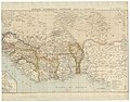
 Carte de la Guinée française - dressée par A. Meunier... - btv1b530296292.jpg 22,400 × 14,626; 44.21 MB
-

-

-
 Morelmaghrebsketch.jpg 760 × 510; 233 KB
-
 Neumann map.jpg 6,957 × 4,816; 10.87 MB
-
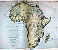 NIE 1905 Africa - physical map.jpg 2,144 × 1,833; 595 KB
-
 NIE 1905 Africa - political map.jpg 2,285 × 1,884; 864 KB
-
 Notes of lessons on the Herbartian method (based on Herbart's plan) (1902) (14803735753).jpg 1,624 × 2,744; 1.33 MB
-

-
 Revue du Pays de Caux n2 mai 1902 (page 23 crop).jpg 982 × 1,148; 209 KB

_-_D%27apr%C3%A8s_les_travaux_de_M.M._Vuillot_et_Barralier_-_btv1b53057662t.jpg)
.jpg)
.jpg)
.jpg)

_(20763950559).jpg)
_(14593532100).jpg)


_(1902)_(14803735753).jpg)
_(14596939910).jpg)
.jpg)