Category:18th-century maps of the fortifications of Batavia
Jump to navigation
Jump to search
Media in category "18th-century maps of the fortifications of Batavia"
The following 34 files are in this category, out of 34 total.
-
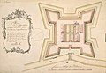
 AMH-2526-NA Ground plan of a fort on the river at Batavia.jpg 2,400 × 1,703; 384 KB
-
 AMH-4588-NA Map of the castle of Batavia.jpg 2,400 × 2,205; 639 KB
-
 AMH-4589-NA Map of the castle of Batavia.jpg 2,400 × 1,909; 511 KB
-
 AMH-5461-NA Map of powder cellars at Batavia.jpg 2,400 × 1,656; 321 KB
-
 AMH-5462-NA Map of the powder cellars at Batavia.jpg 2,400 × 1,896; 412 KB
-
 AMH-7048-KB Map of the fort of Jacatra near Batavia.jpg 2,400 × 2,055; 1.56 MB
-
 AMH-5579-NA Map of Batavia.jpg 1,223 × 2,400; 381 KB
-
 AMH-5433-NA Map of the 'de Robijn' bastion, part of Batavia castle.jpg 2,400 × 1,750; 487 KB
-
 AMH-5434-NA Map of the 'de Saphier' bastion, part of Batavia castle.jpg 2,400 × 1,216; 318 KB
-
 AMH-5436-NA Plan for the Kampen bastion at Batavia.jpg 2,400 × 1,749; 378 KB
-
 AMH-5437-NA Plan of the Zeelandia bastion at Batavia.jpg 2,400 × 1,642; 387 KB
-
 AMH-5438-NA Plan of the Nassau and Oostfriesland bastions at Batavia.jpg 2,400 × 1,661; 403 KB
-
 AMH-5439-NA Plan of the Middelburg bastion at Batavia.jpg 2,400 × 1,681; 396 KB
-
 AMH-5441-NA Plan of the Emkhuizen bastion at Batavia.jpg 2,400 × 1,676; 399 KB
-
 AMH-5442-NA Plan of the Rotterdam bastion at Batavia.jpg 2,400 × 1,699; 426 KB
-
 AMH-5443-NA Plan of the Vianen tower at Batavia.jpg 2,400 × 1,758; 464 KB
-
 AMH-5444-NA Plan of the Catzenellenbogen tower at Batavia.jpg 1,778 × 2,400; 432 KB
-
 AMH-5445-NA Plan of the Nieuwpoort tower at Batavia.jpg 2,400 × 1,518; 384 KB
-
 AMH-5446-NA Plan of the Amsterdam bastion at Batavia.jpg 2,400 × 1,698; 411 KB
-
 AMH-5447-NA Plan of the Diest bastion at Batavia.jpg 2,400 × 1,644; 352 KB
-
 AMH-5448-NA Plan of the Leiden and Westfriesland bastions at Batavia.jpg 2,400 × 1,676; 414 KB
-
 AMH-5449-NA Plan of the Utrecht tower and gate at Batavia.jpg 2,400 × 1,723; 456 KB
-
 AMH-5450-NA Plan of the hornwork at Batavia.jpg 2,400 × 1,635; 352 KB
-
 AMH-5451-NA Plan of the Gelderland bastion at Batavia.jpg 2,400 × 1,644; 437 KB
-
 AMH-5452-NA Plan of the Groningen bastion at Batavia.jpg 2,400 × 2,101; 490 KB
-
 AMH-5453-NA Plan of the Klip tower at Batavia.jpg 2,400 × 1,676; 375 KB
-
 AMH-5454-NA Plan of the Overijssel bastion at Batavia.jpg 2,400 × 2,058; 461 KB
-
 AMH-5455-NA Plan of the Orange bastion at Batavia.jpg 2,400 × 1,788; 365 KB
-
 AMH-5456-NA Plan of the Culemborg bastion at Batavia.jpg 2,400 × 1,715; 418 KB
-
 AMH-5435-NA Plan of the Zeeburg bastion at Batavia.jpg 2,400 × 1,720; 417 KB
-
 AMH-5440-NA Plan of the Hollandia bastion at Batavia.jpg 2,400 × 1,685; 444 KB
-
 AMH-4584-NA Map and elevations of the castle at Batavia.jpg 1,218 × 2,400; 372 KB
-
 AMH-4634-NA Map of the Jacatra entrenchment.jpg 2,400 × 1,662; 563 KB
-
 AMH-5580-NA Plan of Batavia castle's Diamant bastion.jpg 2,400 × 1,394; 456 KB


