Category:18th-century maps of Southeast Asia
Jump to navigation
Jump to search
Subcategories
This category has the following 9 subcategories, out of 9 total.
Media in category "18th-century maps of Southeast Asia"
The following 54 files are in this category, out of 54 total.
-
-

-
 Map of Southeast Asia, 1700.jpg 1,034 × 1,263; 295 KB
-
 B26055990C - Nova tabvla India Orientalis.jpg 6,244 × 4,934; 8.22 MB
-
-
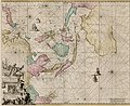
 B26056051C - Insvla Indica cvm terris circvmvicinis.jpg 6,670 × 4,425; 7.22 MB
-
 Carte des Indes et de la Chine COLLBN 009-09-002.tif 8,958 × 8,425; 215.95 MB
-
 Carte des Indes et de la Chine par Guillaume de l'Isle - 1705.png 1,086 × 1,021; 2 MB
-
 1705 map - Carte des Indes et de la Chine.jpg 16,281 × 15,523; 49.69 MB
-

-
-
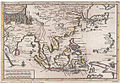 Pieter van der Aa South-East-Asia 1713.jpg 568 × 392; 249 KB
-
 B26055982D - Orientaliora Indiarum Orientalium cum insulis adjacentibus.jpg 5,642 × 4,618; 7.14 MB
-
 Mekong map in 1715.jpg 500 × 700; 54 KB
-
-
 B26055931I - Carte des Indes, de la Chine des Iles de Sumatra, Java.jpg 5,860 × 6,124; 11.21 MB
-
 Map of ancient Southeast Asia, 1719.jpg 1,040 × 1,243; 247 KB
-
 Map of eastern Indonesia, 1719.jpg 851 × 1,021; 172 KB
-
 Map of South and Southeast Asia, 1719.jpg 1,039 × 1,243; 248 KB
-
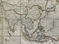
 Map of Southeast Asia, 1719.jpg 1,040 × 1,243; 245 KB
-
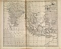
 Map of western Indonesia, 1719.jpg 1,039 × 1,243; 268 KB
-

-
 South Asia, 1744.jpg 6,453 × 5,161; 7.02 MB
-
 AMH-7931-KB Map of the coast of Tonquin and Cochinchina.jpg 1,727 × 2,400; 579 KB
-

-
-
 Southsoutheast1752ne.jpg 800 × 600; 121 KB
-
 Seconde partie de la carte d'Asie.tif 9,783 × 6,768; 189.43 MB
-
 1759 map of the Gulf of Tonkin and the South China Sea.jpg 25,283 × 19,359; 86.78 MB
-

-
-

-

-

-
 Rigobert-Bonne-Atlas-de-toutes-les-parties-connues-du-globe-terrestre MG 0005.tif 5,238 × 3,576; 53.62 MB
-
-

-
 1791 map by Moore, crop on Southeast Asia.jpg 4,018 × 3,669; 3.08 MB
-
 A new chart of the China, with its several entrances.jpg 7,728 × 11,402; 11.95 MB
-

-
 L'Indie (Antonio Zatta 1794, twelve small maps).jpg 532 × 367; 77 KB
-
 Modern Asia WDL154.png 1,024 × 1,287; 2.23 MB
-
 Asia1799.jpg 16,229 × 7,031; 44.52 MB
-

-
-

-

-

-

-
 Carte des royaumes de Siam, de Tunquin, Pegu, Ava Aracan, etc. LOC 2008621653.tif 7,114 × 5,002; 101.81 MB
-
 Indonesia by Ibrahim Muteferrika (1674-1745).png 684 × 512; 799 KB
-
 Map of the Indian Ocean and the China Sea was engraved in 1728 by Ibrahim Müteferrika.jpg 2,552 × 1,914; 5.24 MB
-
 Map shows Indochina and Southeast Asia 1750.jpg 800 × 620; 207 KB
-
 ParacelBank1791.jpg 1,883 × 3,050; 866 KB
.jpg)


,_Malaysia,_Sumatra,_Borneo_-_Geographicus_-_Siam-ottens-1710.jpg)


_the_whole_map_miniature_maps_mostly_from_%27The_Universal_Traveller%27_by_Thomas_Salmon,_London.jpg)


,_1766_East_Indies.jpg)
_-_Geographicus_-_SoutheastAsia-bonne-1770.jpg)
.jpg)
_Robert_de_Vaugondy_G%C3%A9ographe_ord(inaire)_du..._-_btv1b550137444_(124_of_183).jpg)
_Robert_de_Vaugondy_G%C3%A9ographe_ord(inaire)_du..._-_btv1b550137444_(127_of_183).jpg)


.jpg)
.jpg)


.jpg)


.jpg)
.png)


