Category:18th-century maps of Mauritania
Jump to navigation
Jump to search
Countries of Africa: Algeria · Angola · Benin · Cameroon · Cape Verde · Chad · Democratic Republic of the Congo · Republic of the Congo · Djibouti · Egypt‡ · Equatorial Guinea · Eritrea · Ethiopia · The Gambia · Ghana · Guinea · Ivory Coast · Libya · Madagascar · Mauritania · Morocco · Mozambique · Senegal · Sierra Leone · Somalia · South Africa · Sudan · Tanzania · Tunisia
Other areas: Canary Islands · Madeira · Western Sahara
‡: partly located in Africa
Other areas: Canary Islands · Madeira · Western Sahara
‡: partly located in Africa
Subcategories
This category has only the following subcategory.
Media in category "18th-century maps of Mauritania"
The following 7 files are in this category, out of 7 total.
-
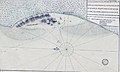 Portendic 1718.jpg 835 × 503; 254 KB
-
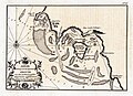
 Plan du fort d'Arguin en 1724 (Mauritanie).jpg 512 × 358; 52 KB
-

-
-

-

-
 Rigobert-Bonne-Atlas-de-toutes-les-parties-connues-du-globe-terrestre MG 0025.tif 3,574 × 5,232; 53.53 MB

.jpg)
.jpg)
,_Maurit%C3%A2nia_-_Image_126698.jpg)
,_Maurit%C3%A2nia_-_Image_126696.jpg)
