Category:18th-century architecture in Oxfordshire
Jump to navigation
Jump to search
Ceremonial counties of England: Bedfordshire · Berkshire · Buckinghamshire · Cambridgeshire · Cheshire · Cornwall · Cumbria · Derbyshire · Devon · Dorset · Durham · East Riding of Yorkshire · East Sussex · Essex · Gloucestershire · Greater London · Greater Manchester · Hampshire · Herefordshire · Hertfordshire · Isle of Wight · Kent · Lancashire · Leicestershire · Lincolnshire · Merseyside · Norfolk · North Yorkshire · Northamptonshire · Northumberland · Nottinghamshire · Oxfordshire · Rutland · Shropshire · Somerset · South Yorkshire · Staffordshire · Suffolk · Surrey · Tyne and Wear · Warwickshire · West Midlands · West Sussex · West Yorkshire · Wiltshire · Worcestershire
City-counties: Bristol ·
Former historic counties: Huntingdonshire · Middlesex · Sussex · Yorkshire
Other former counties:
City-counties: Bristol ·
Former historic counties: Huntingdonshire · Middlesex · Sussex · Yorkshire
Other former counties:
Subcategories
This category has the following 71 subcategories, out of 71 total.
*
A
- Alnutts Hospital (10 F)
B
- Butchers Arms, Balscote (2 F)
- The Bell Inn, Bicester (11 F)
- 20 Sheep Street, Bicester (2 F)
- Malthus Schoolhouse (5 F)
- Braziers Park House (5 F)
- Brick Alley Almshouses (3 F)
- Burford Bridge (9 F)
C
- Chastleton House Dovecote (20 F)
- Chinnor Windmill (2 F)
- Coleshill Mill (7 F)
- Crown and Tuns, Deddington (2 F)
D
- Dashwood Arms, Kirtlington (2 F)
- The Hermitage, Deddington (3 F)
- Denton House, Oxfordshire (3 F)
E
- Bartholomew Room, Eynsham (5 F)
G
- The Plough, Garsington (2 F)
- Goring Mill (9 F)
H
K
- The King's Arms, Oxford (17 F)
- King's Arms, Wheatley (8 F)
- Kings Arms Hotel, Bicester (4 F)
M
- Manor House, Chadlington (2 F)
- Manor House, Drayton (3 F)
- Mason Arms, South Leigh (3 F)
- Mill House, Sutton Courtenay (6 F)
- Mole Inn, Toot Baldon (7 F)
N
- The Nags Head, Abingdon (21 F)
O
- Oxford Arms, Kirtlington (4 F)
- Oxford Canal Bridge 154 (2 F)
- Oxford Canal Bridge 206 (4 F)
- Oxford Canal Bridge 213 (4 F)
- Oxford Canal Bridge 232 (9 F)
- Oxford Canal Bridge 233 (6 F)
- Oxford Canal Bridge 234 (4 F)
- Oxford Canal Bridge 235 (8 F)
- Oxford Canal Bridge 236 (7 F)
- Oxford Canal Bridge 244 (4 F)
P
- Port Mahon, Oxford (8 F)
R
- Radcot Bridge (17 F)
- Red Lion Hotel, Henley-on-Thames (13 F)
- Rock of Gibraltar, Enslow (4 F)
S
- George and Dragon, Shutford (5 F)
- Six Bells, Warborough (5 F)
- Star Inn, Stanton St John (4 F)
T
- Spread Eagle Hotel, Thame (3 F)
- The Trout, Buckland (9 F)
U
W
- Watermill at Charney Bassett (1 F)
- Wheatley Mill, Oxfordshire (22 F)
- Witney Town Hall (13 F)
- Woodside milestone, Marcham (3 F)
- Woodstock Town Hall, Oxfordshire (20 F)
Y
- Yarnton milestone (2 F)
Media in category "18th-century architecture in Oxfordshire"
The following 120 files are in this category, out of 120 total.
-
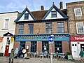
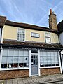
 10 and 11 Upper High Street, Thame, December 2023.jpg 4,032 × 3,024; 4.18 MB
-
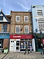
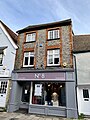
 102 High Street, Thame, December 2023.jpg 4,032 × 3,024; 4.19 MB
-
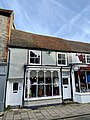
 103 High Street, Thame, December 2023.jpg 3,024 × 4,032; 3.78 MB
-
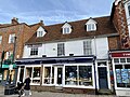 110 and 111 High Street, Thame, December 2023.jpg 4,032 × 3,024; 3.93 MB
-
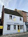 18 Buttermarket, Thame, December 2023.jpg 3,024 × 4,032; 3.18 MB
-
 2 Cornmarket, Thame, December 2023.jpg 4,032 × 3,024; 3.17 MB
-
 2 Upper High Street, Thame, December 2023.jpg 4,032 × 3,024; 4.25 MB
-
 3 and 4 Buttermarket, Thame, December 2023.jpg 4,032 × 3,024; 3.58 MB
-
 3 High Street, Thame, December 2023.jpg 4,032 × 3,024; 3.55 MB
-
 4 and 5 Upper High Street, Thame, December 2023.jpg 4,032 × 3,024; 3.66 MB
-
 5 Buttermarket, Thame, December 2023.jpg 4,032 × 3,024; 3.53 MB
-
 6 Buttermarket, Thame, December 2023.jpg 3,024 × 4,032; 3.01 MB
-
 8 Buttermarket, Thame, December 2023.jpg 3,024 × 4,032; 3.55 MB
-
 8 Upper High Street, Thame, December 2023.jpg 4,032 × 3,024; 4.38 MB
-
 9 and 10 Buttermarket, Thame, December 2023.jpg 4,032 × 3,024; 4.08 MB
-
 9 Buttermarket, Thame, December 2023.jpg 3,024 × 4,032; 3.4 MB
-
 93 High Street, Thame, December 2023.jpg 3,024 × 4,032; 4.2 MB
-
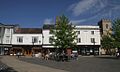
 Abingdon - geograph.org.uk - 291331.jpg 640 × 480; 540 KB
-
 Abingdon Ely's Conduit.jpg 854 × 1,280; 612 KB
-
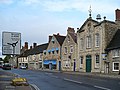
 Abingdon MarketSquare17–21.jpg 1,024 × 614; 313 KB
-
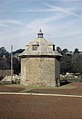
 The courtyard and clock tower of Clock House (geograph 3933468).jpg 1,500 × 976; 179 KB
-
 The Centre of Bampton - geograph.org.uk - 471628.jpg 640 × 480; 97 KB
-
 Baulking StNicholas date.jpg 1,280 × 853; 402 KB
-
 Old Milestone (geograph 6114690).jpg 1,423 × 1,809; 622 KB
-
 Begbroke Milestone.jpg 2,000 × 3,000; 2.82 MB
-

-
 Fyfield Manor.jpg 1,500 × 1,110; 543 KB
-
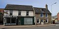 Bicester SheepSt 73–75.jpg 1,024 × 512; 261 KB
-
 Bicester SheepSt 86–84.jpg 1,024 × 614; 324 KB
-
 Bicester SheepSt 88.jpg 1,024 × 614; 372 KB
-
 Bicester SheepSt 88–84.jpg 1,024 × 614; 297 KB
-
 Bletchingdon OldRedLion.JPG 3,000 × 1,800; 2.3 MB
-
 Start of a footpath - geograph.org.uk - 1366226.jpg 400 × 600; 51 KB
-
 Bridge 149 on the Oxford Canal - geograph.org.uk - 65485.jpg 640 × 427; 94 KB
-
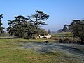 Bridge in Brightwell Park (geograph 2253436).jpg 3,648 × 2,736; 1.32 MB
-
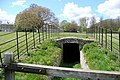 Ice house in Brightwell Park (geograph 3444810).jpg 640 × 427; 204 KB
-
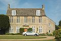
 Britwell Salome House - geograph.org.uk - 138007.jpg 640 × 480; 91 KB
-
 Home Farm Dovecote, Buckland Geograph-2437996-by-Des-Blenkinsopp.jpg 3,096 × 2,232; 1.6 MB
-
 Buckland Aviary.jpg 949 × 712; 587 KB
-
 Bullingdon House, 2 Buttermarket, Thame, December 2023.jpg 4,032 × 3,024; 2.89 MB
-
 Tomb of Robert Aston, Burford Geograph-3657382-by-Dave-Hitchborne.jpg 640 × 426; 112 KB
-
 Charlbury MarketSt CornerHouse WSW.jpg 1,280 × 1,278; 718 KB
-
 Chilton AllSaints MonumentHead.jpg 614 × 1,024; 296 KB
-
 Chilton AllSaints MonumentKnapp.jpg 614 × 1,024; 282 KB
-
 Chinnor Oxon Red Lion.JPG 2,559 × 1,851; 2.08 MB
-
 Chinnor, The Red Lion public house - geograph.org.uk - 751495.jpg 640 × 461; 65 KB
-
-

-
-
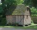
 KnightonFarm barn.jpg 1,024 × 614; 315 KB
-
 ComptonBeauchamp StSwithun NW.jpg 1,024 × 512; 231 KB
-

-
 Cumnor VineInn.JPG 2,990 × 1,920; 687 KB
-
 Paper Mill Cottages - geograph.org.uk - 447806.jpg 640 × 450; 134 KB
-
 Milestone near Dorchester Abbey - geograph.org.uk - 1419424.jpg 640 × 426; 124 KB
-
 Drayton RedLion.jpg 1,024 × 512; 291 KB
-
 Church Street, Eynsham - geograph.org.uk - 1439862.jpg 640 × 480; 88 KB
-
 Finstock pub.jpg 640 × 480; 110 KB
-
 Coombe End Farm - geograph.org.uk - 1386432.jpg 640 × 426; 201 KB
-
 Copyhold Farm - geograph.org.uk - 1166838.jpg 640 × 426; 193 KB
-
 GreatFaringdon MarketPlace 23-24.JPG 3,000 × 2,000; 2.31 MB
-
 Cob wall in Harwell - geograph.org.uk - 1483279.jpg 640 × 480; 138 KB
-
 Henley-on-Thames ReadingRd 273–281.jpg 1,280 × 1,215; 565 KB
-
 Old Milestone (geograph 6115259).jpg 1,115 × 1,382; 245 KB
-
 House near Kelmscott Manor - geograph.org.uk - 309864.jpg 640 × 480; 92 KB
-
 Country pub - geograph.org.uk - 1670022.jpg 3,648 × 2,736; 4.32 MB
-
 The Crown Public House, Marcham - geograph.org.uk - 91520.jpg 640 × 481; 41 KB
-
 Marcham GozzardsFord BlackHorse.jpg 3,000 × 1,800; 2.28 MB
-
 The Marlborough, Witney - geograph.org.uk - 871346.jpg 640 × 480; 76 KB
-
 Masonic Hall - Church Green - geograph.org.uk - 3599020.jpg 640 × 480; 107 KB
-
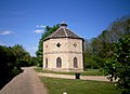
 Dovecote, Milcombe Hall - geograph.org.uk - 214618.jpg 440 × 640; 52 KB
-
 St James, Nether Worton, Oxon - Font - geograph.org.uk - 1615526.jpg 425 × 640; 44 KB
-
 Nettlebed BullInn.jpg 1,280 × 614; 498 KB
-
 Nettlebed HighSt 22.jpg 1,279 × 1,280; 620 KB
-
 NorthLeigh Vicarage.jpg 2,910 × 1,940; 744 KB
-
 Northmoor RectoryFarm granary.JPG 2,350 × 1,880; 2.03 MB
-
 Northmoor StDenys Lydall1701.jpg 3,000 × 2,000; 2.05 MB
-
 Nuffield EnglishFarm EastRange SSW.jpg 1,280 × 641; 357 KB
-
 Nuffield EnglishFarm EastRange WSW.jpg 1,280 × 720; 394 KB
-
 Old Milestone (geograph 6115148).jpg 1,050 × 1,586; 225 KB
-
 Old Milestone by the A4095, Woodgreen Hill, Witney parish (geograph 6048688).jpg 1,141 × 2,083; 474 KB
-

-
 Castello di oxford 05.JPG 2,592 × 1,944; 675 KB
-
 Flight 9.9.06b 011.jpg 2,816 × 2,112; 3.58 MB
-
 Round tower - geograph.org.uk - 1392674.jpg 640 × 480; 68 KB
-
 St George's Tower - geograph.org.uk - 1479929.jpg 640 × 480; 67 KB
-
 Towers at the castle - geograph.org.uk - 1391443.jpg 640 × 480; 70 KB
-
 Oxford Castle.JPG 1,224 × 1,632; 445 KB
-
 Oxford-castle.jpg 2,592 × 1,936; 803 KB
-
 Outbuilding, The Crown, Pishill - geograph.org.uk - 755085.jpg 480 × 640; 182 KB
-
 The B480, Pishill - geograph.org.uk - 755084.jpg 640 × 480; 138 KB
-

-
 Shirburn (Oxon) All Saints Church - geograph.org.uk - 69744.jpg 640 × 480; 106 KB
-
 Obelisk, garden of Shotover House - geograph.org.uk - 190859.jpg 640 × 480; 162 KB
-
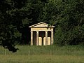
 Temple at Shotover House - geograph.org.uk - 192060.jpg 479 × 640; 129 KB
-
 Shrivenham StAndrew southwest.JPG 2,925 × 1,950; 679 KB
-
 Shrivenham StAndrew west.JPG 2,400 × 1,920; 559 KB
-
 Somerton Deep Lock on the Oxford Canal - geograph.org.uk - 30508.jpg 480 × 640; 109 KB
-
 Octagonal buildings, Ascott Park - geograph.org.uk - 139690.jpg 640 × 480; 91 KB
-
 StantonStJohn HolfordCentre East.jpg 2,980 × 1,490; 1.66 MB
-
 The Cherry Tree in Steventon - geograph.org.uk - 1256439.jpg 640 × 427; 62 KB
-
 Steventon - geograph.org.uk - 14192.jpg 600 × 617; 70 KB
-
 SuttonCourtenay HighSt LongBarn.jpg 1,280 × 1,280; 712 KB
-
 The Five Horseshoes Public House - geograph.org.uk - 88657.jpg 640 × 481; 37 KB
-
 Old Milestone (geograph 6114477).jpg 793 × 1,457; 150 KB
-
 Uffington church - geograph.org.uk - 1175199.jpg 640 × 480; 71 KB
-
 The Six Bells - geograph.org.uk - 1725834.jpg 1,024 × 683; 144 KB
-
 Old Milestone by the A420 in Watchfield (geograph 5622336).jpg 1,082 × 1,672; 266 KB
-
 Watchfield milestone.jpg 683 × 1,024; 655 KB
-
 NorthfieldFarm barn.jpg 1,024 × 614; 410 KB
-
 Thatched wall in West Hagbourne - geograph.org.uk - 1288941.jpg 640 × 427; 96 KB
-
 Wilcote Grange Barn.JPG 3,000 × 2,000; 2.61 MB
-
 High Street, Witney - geograph.org.uk - 1010325.jpg 640 × 480; 92 KB
-
 Witney ... the Post Office. (5457288134).jpg 2,225 × 1,811; 2.93 MB
-

-
 Witney HighSt 75–79.jpg 1,280 × 652; 437 KB
-
 Woodeaton HolyRood pulpit.JPG 2,000 × 3,000; 2.83 MB
-
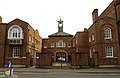
 Woodeaton Manor School - geograph.org.uk - 351029.jpg 640 × 479; 110 KB
-
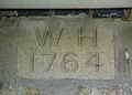 Wootton StPeter DateStone1764.jpg 2,660 × 1,900; 1.67 MB
-
 Mill Lane, Wootton - geograph.org.uk - 1116571.jpg 640 × 426; 101 KB


.jpg)


.jpg)


.jpg)
.jpg)


.jpg)


.jpg)
.jpg)


_All_Saints_Church_-_geograph.org.uk_-_69744.jpg)


.jpg)


.jpg)


.jpg)


