Category:1898 maps of Europe
Jump to navigation
Jump to search
Temperate regions: North America · South America · Africa · Europe · Asia · Oceania – Polar regions: – Other regions:
English: 1898 maps of Europe
Español: Mapas de Europa en 1898
Suomi: Euroopan kartat vuodelta 1898
Română: Hărți ale Europei din 1898
Subcategories
This category has the following 16 subcategories, out of 16 total.
-
.
- 1898 maps of the Ottoman Empire (empty)
F
- 1898 maps of Finland (5 F)
G
I
- 1898 maps of Italy (24 F)
N
- 1898 maps of Norway (6 F)
P
- 1898 maps of Poland (7 F)
R
- 1898 maps of Russia (7 F)
S
- 1898 maps of Spain (6 F)
- 1898 maps of Switzerland (3 F)
U
Media in category "1898 maps of Europe"
The following 21 files are in this category, out of 21 total.
-
 100 of '(Our own country. Descriptive, historical, pictorial.)' (11292897346).jpg 1,168 × 1,326; 397 KB
-

-

-

-

-

-
-

-

-

-
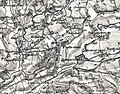
 Felton detail in OS Hereford (Hills) sheet 198 - 1898.jpg 1,249 × 751; 1.09 MB
-
 Little Cowarne detail in OS Hereford (Hills) sheet 198 - 1898.jpg 790 × 677; 602 KB
-
 Pudleston OS Sheet 198 Hereford (Hills) 1898 + OS Sheet 181 Ludlow (Hills) 1899.jpg 1,193 × 930; 1.23 MB
-
 62 of 'China in Transformation ... With ... maps and diagrams' (11245514394).jpg 1,430 × 1,665; 648 KB
-

-
 Admiralty Chart No 2989 Entrance to the Loire River and approaches to St. Nazaire, Published 1898.jpg 16,206 × 11,085; 65.91 MB
-
 Europe. LOC 99466751.jpg 8,539 × 6,532; 11.69 MB
-
 Europe. LOC 99466751.tif 8,539 × 6,532; 159.58 MB
-

-
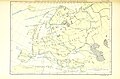
 Map of Europe (1898).jpg 2,931 × 2,360; 1.33 MB
-
 Plans d’alignement du quartier Berkendael.png 303 × 190; 83 KB
%27_(11292897346).jpg)
%27_(11248781964).jpg)
%27_(11247742473).jpg)
%27_(11245236273).jpg)
%27_(11245555095).jpg)
%27_(11248807874).jpg)
%27_(11248563966).jpg)
%27_(11247364493).jpg)
%27_(11244911993).jpg)
%27_(11245094735).jpg)
_sheet_198_-_1898.jpg)
_sheet_198_-_1898.jpg)
_1898_%2B_OS_Sheet_181_Ludlow_(Hills)_1899.jpg)
.jpg)


.jpg)

.jpg)