Category:1897 maps
Jump to navigation
Jump to search
| ← · 1890 · 1891 · 1892 · 1893 · 1894 · 1895 · 1896 · 1897 · 1898 · 1899 · → |
Deutsch: Karten mit Bezug zum Jahr 1897
English: Maps related to the year 1897
Español: Mapas relativos al año 1897
Français : Cartes concernant l’an 1897
Русский: Карты 1897 года
Subcategories
This category has the following 9 subcategories, out of 9 total.
*
A
E
N
O
S
Media in category "1897 maps"
The following 112 files are in this category, out of 112 total.
-
 GRUNDY(1894) p091 MAP OF NORTHERN PORTION OF PLATEA.jpg 3,980 × 2,578; 4.09 MB
-
 HERODOTUS(1897) p2.294 PLATAEA.jpg 1,058 × 1,612; 1 MB
-
 R.E.Call (1897) Map of the Mammoth Cave.jpg 2,581 × 1,736; 1.38 MB
-
 HURLEY(1897) p031 Map of Hong Kong and Victoria Bay.jpg 5,635 × 4,489; 11.72 MB
-
 HURLEY(1897) p044 Map of the RICHMOND ESTATE Property.jpg 2,369 × 2,161; 2.45 MB
-
 HURLEY(1897) p060 Plan of Central District.jpg 2,349 × 1,511; 1.9 MB
-
 HURLEY(1897) p165 Map of the Vicinity of Hong Kong.jpg 4,502 × 3,321; 4.77 MB
-
 HURLEY(1897) p172 Map of the KOWLOON ESTATE Property.jpg 5,079 × 4,285; 6.8 MB
-
 1897 administrative map of the Marshall Islands, Pacific Ocean.jpg 1,254 × 1,412; 609 KB
-

-
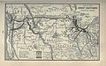 1897 Poor's Great Northern Railway.jpg 4,126 × 2,592; 2.23 MB
-
 1897 Poor's Southern Pacific Company Pacific System.jpg 2,684 × 4,126; 2.31 MB
-
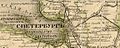 1897 жел дор Петербурга.jpg 1,151 × 465; 314 KB
-

-
 Affonso Hebert - Planta do Rincão da Ponta Grossa.jpg 2,000 × 916; 313 KB
-
 Alexander97.jpg 986 × 672; 192 KB
-

-
 Anales de la Sociedad Española de Historia Natural (1897) (17546175593).jpg 1,650 × 2,776; 742 KB
-
 Annual report of the Secretary of the Board of Agriculture" (1854-1915) (19341061446).jpg 2,656 × 1,750; 1.84 MB
-
 Biakmap.tiff 1,911 × 2,679; 12.12 MB
-
 Messtischblatt 4107 Borken 1897.jpg 8,232 × 8,713; 13.42 MB
-
 Brasov 1897.jpg 1,584 × 1,000; 704 KB
-
 Messtischblatt 4206 Bruenen 1897.jpg 8,223 × 8,692; 13.8 MB
-
 Messtischblatt 4110 Buldern 1897.jpg 8,204 × 8,687; 11.96 MB
-
 CGWMapCirca1897.png 522 × 524; 263 KB
-

-

-
 Cover - front and back.) NYPL1517363.tiff 2,069 × 2,071; 12.27 MB
-
 District map of the lower Mississippi River (8347224414).jpg 655 × 800; 138 KB
-
 Messtischblatt 4109 Duelmen 1897.jpg 8,205 × 8,665; 13.64 MB
-
 Early Tordesillas lines.jpg 3,010 × 1,520; 673 KB
-
 Eliyahu Ze'ev Levin-Epstein, תכנית מושב רחבות (FL6878321 2369502).jpg 2,637 × 2,350; 2.3 MB
-
 Enchanted-Mesa-Map-1897.png 368 × 613; 179 KB
-
 EB 1911 Map Fig 18.png 2,174 × 1,392; 2.5 MB
-
 Ethnic population of the Caucasus according to the Russian census of 1897.JPG 2,328 × 1,098; 249 KB
-
 Eupen (Karte des Deutschen Reiches, 455. Eupen) - urn-nbn-de-0128-1-12764.jpg 5,241 × 4,466; 4.69 MB
-

-
 Friedrich Wilhelm Putzger, Palästina (FL37124362 3902707).jpg 2,993 × 3,833; 4.52 MB
-
 From Boston to Klondike or a trip to the gold regions. LOC 92686130.jpg 8,408 × 6,155; 4.99 MB
-
 From Boston to Klondike or a trip to the gold regions. LOC 92686130.tif 8,408 × 6,155; 148.06 MB
-
 Going to Klondyke. LOC 99446193.jpg 5,956 × 4,654; 6.21 MB
-
 Going to Klondyke. LOC 99446193.tif 5,956 × 4,654; 79.31 MB
-
 Messtischblatt 4108 Gr Reken 1897.jpg 8,257 × 8,706; 13.37 MB
-
 HempsteadRR-1897.JPG 783 × 628; 124 KB
-
 Henry Martyn Field, Palestine (FL45611936 3951822).jpg 1,442 × 2,357; 1.38 MB
-
 History of the Civil War in the United States, 1860-1865 LOC 99447170.jpg 9,220 × 12,839; 19.14 MB
-
 History of the Civil War in the United States, 1860-1865 LOC 99447170.tif 9,220 × 12,839; 338.68 MB
-
 Hyacinthe Le Carguet Vestiges archéologiques de Sein.jpg 1,346 × 760; 383 KB
-
 Inside cover.) NYPL1517364.tiff 2,063 × 2,069; 12.22 MB
-
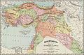
 La région du Haut Nil LOC 2019589338.jpg 4,539 × 7,701; 5.53 MB
-
 La région du Haut Nil LOC 2019589338.tif 4,539 × 7,701; 100.01 MB
-
 Langwedel Wall Mühle 1897.png 250 × 212; 71 KB
-
 Messtischblatt 4640 Leipzig von 1897 df dk 0000094.jpg 7,515 × 7,446; 10.39 MB
-
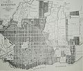 Map Kingston 1897.jpg 1,500 × 1,282; 409 KB
-
 Map of Dimmit County - Land and Tax Department, Texas and Pacific R'y Co. LOC 2009583806.jpg 8,658 × 6,846; 7.12 MB
-
 Map of Dimmit County - Land and Tax Department, Texas and Pacific R'y Co. LOC 2009583806.tif 8,658 × 6,846; 169.58 MB
-
 Map of Lower Orinoco pub. 1897.jpg 1,014 × 747; 226 KB
-

-

-
 Map showing the locations of meetings within the limits of Philadelphia Yearly Meeting. LOC 78693053.tif 8,586 × 10,026; 246.29 MB
-
 Map Transsib Railway 1897.png 2,223 × 1,113; 717 KB
-
 Maurice B. Adams map of Bedford Park 1897.jpg 1,127 × 1,074; 498 KB
-
 Messtischblatt 4413 Werl 1897 Ausschnitt Hilbeck Dorfkern.png 1,261 × 926; 1.78 MB
-
 Messtischblatt 4413 Werl 1897 Ausschnitt Hilbeck.png 2,668 × 2,764; 9.95 MB
-
 Messtischblatt 4413 Werl 1897 Rechteck.png 6,697 × 6,424; 58.64 MB
-
 Messtischblatt 4413 Werl 1897.png 8,352 × 9,760; 81.7 MB
-
 Modern Palestine, part of Turkey (FL42848163 3922634).jpg 4,798 × 3,317; 10.05 MB
-
 Molokai Hawaiian Islands 1906.jpg 12,599 × 6,637; 5.22 MB
-
 Molokai LOC 2005625316.jpg 10,681 × 5,480; 8.09 MB
-
 Molokai LOC 2005625316.tif 10,681 × 5,480; 167.46 MB
-
 Morava.1897.jpeg 2,175 × 1,632; 1.83 MB
-
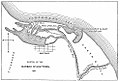
 Mosul Province 1897.png 920 × 626; 1.02 MB
-
 Oradea 1897.jpg 1,785 × 1,200; 626 KB
-
 Messtischblatt 4111 Ottmarsbocholt 1897.jpg 8,275 × 8,713; 12.47 MB
-
 Palestine Divided among The Twelve Tribes (FL35090282 3892050).jpg 4,262 × 5,416; 35.53 MB
-
 Pall Mall (West) 1890s.jpg 1,092 × 507; 355 KB
-
 Peta soerabaja 1897.jpg 895 × 1,364; 335 KB
-
 Piccadilly (South-West) 1890s.jpg 1,710 × 1,008; 917 KB
-
 Piccadilly locations mentioned in Dracula.jpg 1,106 × 844; 503 KB
-
 Plan of land of Onset and Point Independence (9138252014).jpg 800 × 776; 151 KB
-
 Plan-tram-rennes-1897.svg 586 × 362; 19 KB
-
 PlanCalvet1897.jpg 500 × 388; 103 KB
-
 Plano de Santiago.jpg 2,382 × 3,036; 6.58 MB
-
 Provincia de Tarapaca-1895.jpg 3,083 × 4,551; 11.46 MB
-
 PSM V51 D316 Stature in lower brittany.png 1,942 × 1,388; 987 KB
-
 PSM V51 D637 Basque french language boundary.png 1,156 × 1,131; 153 KB
-
 PSM V51 D749 Cephalic index of liguria and vicinity.png 2,173 × 1,932; 674 KB
-
 PSM V52 D172 Cephalic index of norway.png 1,180 × 1,836; 318 KB
-
 PSM V52 D332 Cephalic index map of the netherlands.png 1,639 × 1,993; 308 KB
-
 PSM V52 D759 Big cottonwood power company dam.png 3,024 × 1,730; 1.58 MB
-
 Messtischblatt 4207 Raesfeld 1897.jpg 1,654 × 1,722; 885 KB
-
-
 Messtischblatt 4106 Rhede 1897.jpg 8,204 × 8,704; 14.13 MB
-
 Salagagebiet1897 003.jpg 1,508 × 1,535; 374 KB
-
 Sea of Galilee.Lake Of Gennersaret. Sea of Chinnereth (FL45611980 3954745).jpg 1,403 × 2,168; 1,002 KB
-
 Haustenbeck cropped out of Messtischblatt 4118 Senne 1897.png 1,280 × 863; 2.21 MB
-
 Sidi Ali Ben Hosein's Mohit 1554.png 1,976 × 1,396; 774 KB
-
 Spezialkarte der Österreichisch-ungarischen Monarchie - Marburg 1897.jpg 14,481 × 11,490; 33.79 MB
-
 Spezialkarte der Österreichisch-ungarischen Monarchie - Pragerhof und Wind. Feistritz 1897.jpg 14,347 × 11,491; 32.75 MB
-
 Spezialkarte der Österreichisch-ungarischen Monarchie - Weixelburg und Zirknitz 1897.jpg 14,689 × 11,406; 34.06 MB
-
 The Madaba mosaic Map - Jerusalem section (FL6880628 2369813).jpg 3,010 × 2,026; 2.73 MB
-
 Topographische Karte 1 25000 Blatt 43 (7020) Bietigheim 1897.jpg 4,402 × 4,163; 6.34 MB
-
 Topographische Karte 1 25000 Blatt 43 (7020) Bietigheim 1897.png 8,771 × 8,286; 147.47 MB
-
 Tramwayrennes1897.svg 1,373 × 929; 64 KB
-
-
 Verlauf Dürre Enz Oberriexingen 1897.png 1,392 × 1,404; 3.69 MB
-
 Viborgs län 1897.png 1,892 × 1,788; 2.08 MB
-
 Viktoriasee Südufer 1897 2.png 4,297 × 3,318; 3.27 MB
-
 Viktoriasee Südufer 1897.jpg 4,297 × 3,318; 3.09 MB
-
 Messtischblatt 4208 Wulfen 1907 Rechteck.jpg 7,318 × 7,054; 10.95 MB
-

-
 Австрийско приморие 1897.jpg 756 × 1,000; 326 KB
_p091_MAP_OF_NORTHERN_PORTION_OF_PLATEA.jpg)
_p2.294_PLATAEA.jpg)
_Map_of_the_Mammoth_Cave.jpg)
_p031_Map_of_Hong_Kong_and_Victoria_Bay.jpg)
_p044_Map_of_the_RICHMOND_ESTATE_Property.jpg)
_p060_Plan_of_Central_District.jpg)
_p165_Map_of_the_Vicinity_of_Hong_Kong.jpg)
_p172_Map_of_the_KOWLOON_ESTATE_Property.jpg)


.jpg)


_(17546175593).jpg)
_(19341061446).jpg)


.jpg)
.jpg)
.jpg)


.jpg)


_-_urn-nbn-de-0128-1-12764.jpg)

.jpg)


.jpg)


_(14595649540)_(cropped).jpg)


.jpg)


.jpg)
_1890s.jpg)

_1890s.jpg)

.jpg)


.jpg)


.jpg)


.jpg)
_Bietigheim_1897.jpg)
_Bietigheim_1897.png)


