Category:1890s maps of Saxony
Jump to navigation
Jump to search
|
Federal states of Germany: |
Media in category "1890s maps of Saxony"
The following 7 files are in this category, out of 7 total.
-

-
 Meyers leiner Hand-atlas 1893 (73136638).jpg 9,480 × 6,410; 11.25 MB
-
 Meyers leiner Hand-atlas 1893 (73136663).jpg 9,503 × 6,375; 11.89 MB
-
 Meyers leiner Hand-atlas 1893 (73136690).jpg 9,516 × 6,395; 11.72 MB
-
-
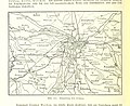
 Karte des Deutschen Reiches von 1893 (417) Dresden 5820417c.jpg 11,864 × 10,835; 34.82 MB
-
 Karte des Deutschen Reiches von 1893 (444) Königstein 5820444c.jpg 11,935 × 10,839; 37.55 MB
.jpg)
.jpg)
.jpg)
.jpg)
.jpg)
_Dresden_5820417c.jpg)
_K%C3%B6nigstein_5820444c.jpg)