Category:1886 maps of North America
Jump to navigation
Jump to search
Temperate regions: North America · South America · Africa · Europe · Asia · Oceania – Polar regions: – Other regions:
English: 1886 maps of North America
Subcategories
This category has the following 4 subcategories, out of 4 total.
Media in category "1886 maps of North America"
The following 10 files are in this category, out of 10 total.
-

-
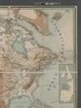
 H. Kiepert's physikalische Wandkarten (NYPL b20762154-5437637).jpg 7,610 × 9,757; 68.06 MB
-
 H. Kiepert's physikalische Wandkarten (NYPL b20762154-5437637).tiff 7,760 × 10,328, 2 pages; 229.61 MB
-
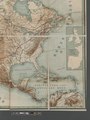
 H. Kiepert's physikalische Wandkarten (NYPL b20762154-5437638).jpg 7,425 × 9,808; 64.04 MB
-
 H. Kiepert's physikalische Wandkarten (NYPL b20762154-5437638).tiff 7,760 × 10,328, 2 pages; 229.61 MB
-
 H. Kiepert's physikalische Wandkarten (NYPL b20762154-5437639).jpg 7,554 × 9,564; 64.02 MB
-
 H. Kiepert's physikalische Wandkarten (NYPL b20762154-5437639).tiff 7,760 × 10,328, 2 pages; 229.61 MB
-
 H. Kiepert's physikalische Wandkarten (NYPL b20762154-5437640).jpg 7,497 × 9,581; 64.8 MB
-
 H. Kiepert's physikalische Wandkarten (NYPL b20762154-5437640).tiff 7,760 × 10,328, 2 pages; 229.61 MB
-
 H. Kiepert's physikalische Wandkarten (NYPL b20762154-5437641).tiff 13,465 × 13,922; 536.61 MB
.jpg)
.jpg)
.jpg)
.jpg)
.jpg)