Category:1880s maps of Persia, Afghanistan and Baluchistan
Jump to navigation
Jump to search
English: This category collects maps showing the full ensemble of Persia, Afghanistan and Baluchistan in the 1880s
Media in category "1880s maps of Persia, Afghanistan and Baluchistan"
The following 10 files are in this category, out of 10 total.
-
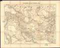
 Persia, Afghanistan and Baluchistan WDL12985.png 1,319 × 1,024; 3.44 MB
-
 Persia, Afghanistan and Beluchistan. LOC 2006626070.jpg 4,164 × 3,231; 4.6 MB
-
 Persia, Afghanistan and Beluchistan. LOC 2006626070.tif 4,164 × 3,231; 38.49 MB
-
 Persia, Afghanistan and Beluchistan. LOC 2006626071.jpg 4,217 × 3,369; 3.44 MB
-
 Persia, Afghanistan and Beluchistan. LOC 2006626071.tif 4,217 × 3,369; 40.65 MB
-
 Palestine, or, the Holy Land ; Persia, Afghanistan and Beluchistan. LOC 2006627700.jpg 6,110 × 8,335; 10.97 MB
-
 Palestine, or, the Holy Land ; Persia, Afghanistan and Beluchistan. LOC 2006627700.tif 6,110 × 8,335; 145.7 MB
-
 Palestine, or, the Holy Land; Persia, Afghanistan and Beluchistan WDL12989.png 1,024 × 1,396; 3.22 MB
-
 Stanford's Map of Western Asia.png 7,677 × 6,053; 84.03 MB
-
 Stanfords Map of Western Asia.jpg 7,677 × 6,053; 16.02 MB


