Category:1880s maps of Chicago
Jump to navigation
Jump to search
Media in category "1880s maps of Chicago"
The following 15 files are in this category, out of 15 total.
-
 1880 Mitchell map of Chicago.jpg 5,711 × 9,423; 12.57 MB
-
 1881 Chicago map by Gray & Son.jpg 6,053 × 6,817; 9.26 MB
-
 1884 map of Chicago showing extensions to city limits.jpg 1,986 × 2,969; 1.83 MB
-
 1885 Humboldt Park Map personal photograph, by myself, of my map.jpg 2,048 × 1,536; 2.81 MB
-
 1885 Mitchell map of Chicago.jpg 5,707 × 6,459; 5.33 MB
-
 1886 Chicago map by Rand McNally.jpg 3,602 × 4,539; 4.98 MB
-
 1886 Snyder's real estate map of Cook County, Illinois.jpg 18,812 × 22,407; 89.99 MB
-
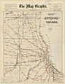
 1887 Map of Chicago and Environs by Blanchard.jpg 9,360 × 12,541; 22.96 MB
-
 1888 Blanchard's map of Chicago.jpg 4,779 × 7,152; 26.21 MB
-
 1888 Chicago map by Blanchard.jpg 5,419 × 7,065; 5.43 MB
-
 1888 Chicago map by Rand McNally.jpg 6,839 × 8,669; 8.32 MB
-
 1888 Cram map of Chicago.jpg 4,363 × 5,475; 12.51 MB
-
 1892 Worlds Exposition Chicago.jpg 10,627 × 10,150; 10.52 MB
-
 1889 Guide map of new Chicago and suburbs by Stine & Clark.jpg 9,262 × 13,700; 27.47 MB
-
 Haymarket Affair map Chicago Tribune may 5, 1886.jpg 2,448 × 3,264; 1.97 MB


