Category:1876 maps of Indiana
Jump to navigation
Jump to search
States of the United States: California · Hawaii · Illinois · Indiana · Kentucky · Louisiana · Massachusetts · Michigan · Missouri · New Jersey · New York · Ohio · Oklahoma · Oregon · Pennsylvania · South Carolina · Texas · Utah – Washington, D.C.
| 1875 1876 1879 → |
Subcategories
This category has only the following subcategory.
Media in category "1876 maps of Indiana"
The following 4 files are in this category, out of 4 total.
-
 Covington, Indiana map from 1876 atlas.jpg 1,302 × 946; 862 KB
-
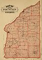 Fountain County, Indiana map from 1876 atlas.jpg 1,521 × 2,190; 2.59 MB
-
 Fremont, Indiana 1876.PNG 448 × 468; 434 KB
-
 Waterloo, Indiana 1876.PNG 681 × 491; 564 KB


