Category:1872 maps
Jump to navigation
Jump to search
| ← · 1870 · 1871 · 1872 · 1873 · 1874 · 1875 · 1876 · 1877 · 1878 · 1879 · → |
Deutsch: Karten mit Bezug zum Jahr 1872
English: Maps related to the year 1872
Español: Mapas relativos al año 1872
Français : Cartes concernant l’an 1872
Русский: Карты 1872 года
Subcategories
This category has the following 9 subcategories, out of 9 total.
Media in category "1872 maps"
The following 174 files are in this category, out of 174 total.
-
 'Around the World in Eighty Days' by Neuville and Benett 01.jpg 800 × 650; 130 KB
-

-

-
 Fullarton, A. & Co. Caucausus & Crimea. 1872 (A).jpg 2,412 × 3,684; 2.07 MB
-
 Fullarton, A. & Co. Caucausus & Crimea. 1872 (N).jpg 1,871 × 1,091; 585 KB
-
 Fullarton, A. & Co. Caucausus & Crimea. 1872 (P).jpg 743 × 453; 96 KB
-
 Orientierungskarte zu der Eroberung Preussens durch die Deutschen.jpg 2,804 × 2,225; 1.66 MB
-
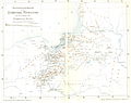
 SHAIRP(1872) p263 Map of a portion of LAPLAND.jpg 5,496 × 4,365; 7.88 MB
-
 WEISS(1872) p029 Römische Anlagen bei VINDOBONA.jpg 1,584 × 2,472; 2.24 MB
-
 WEISS(1872) p295 Wiens Stadtentwicklung bis zum Ende des 15. Jahrhunderts.jpg 5,022 × 4,002; 10.31 MB
-
 Map of the Country of the Upper Oxus.jpg 3,789 × 2,543; 4.93 MB
-
 Map of the River Indus.jpg 2,497 × 5,331; 5.78 MB
-
 1872 Atlas view of Cooperage.jpg 1,600 × 1,200; 1.13 MB
-
 1872 Beers Map of Newark, New Jersey - Geographicus - Newark-beers-1872.jpg 5,000 × 3,511; 4.41 MB
-
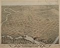
 1872 Birds Eye View of Columbus Ohio by Bailey LC (cropped).jpg 1,990 × 1,147; 304 KB
-
 1872 Birds Eye View of Columbus Ohio by Bailey LC.jpg 11,360 × 7,064; 7.78 MB
-
 1872 Chicago & Canada Southern.jpg 11,648 × 5,856; 19.49 MB
-
 1872 Colton Map of Antarctica or the South Pole - Geographicus - SouthPole-colton-1872.jpg 3,500 × 4,332; 3.74 MB
-
 1872 Colton Map of the North Pole or Arctic - Geographicus - NorthPole-colton-1872.jpg 3,500 × 4,266; 4.46 MB
-
 1872 Mitchell Map of Cuba and the Bahamas - Geographicus - Cuba-mitchell-1872.jpg 4,437 × 3,503; 6.12 MB
-

-
 AcquackanonkTownshipNewJersey1872.JPG 500 × 700; 120 KB
-
 Admiralty Chart No 2536 a & b Crete, Published 1858 1862, Large corrections 1872.jpg 9,000 × 3,118; 7.78 MB
-
 Atlas of the City of Buffalo, New York (Title page) NYPL1575867.tiff 5,178 × 6,516; 96.53 MB
-
 Aufnahmeblatt 4656-4b Greifenstein-Gugging.jpg 10,154 × 7,409; 43.48 MB
-
 Aufnahmeblatt 4656-4c Ausschnitt Tulbing.jpg 684 × 681; 238 KB
-
 Aufnahmeblatt 4657-2 Gaunersdorf, Groß Schweinbarth.jpg 10,108 × 9,314; 54.04 MB
-
 Aufnahmeblatt 4756-2a Purkersdorf, Tullnerbach, Troppberg.jpg 10,208 × 7,322; 42.67 MB
-
 Aufnahmeblatt 4756-4a Sulz, Kaltenleutgeben, Höllenstein.jpg 10,192 × 7,283; 45.17 MB
-
 Aufnahmeblatt 4756-4c Heiligenkreuz, Hoher Lindkogel.jpg 10,318 × 7,428; 46.03 MB
-
 Aufnahmeblatt 4757-3b Rauchenwarth.jpg 10,287 × 7,330; 38.89 MB
-
 Aufnahmeblatt 4856-1b Weißenbach an der Triesting, Neuhaus.jpg 10,348 × 7,519; 45.35 MB
-
 Aufnahmeblatt 4857-1d Stotzing Au Loretto.jpg 10,270 × 7,465; 36.27 MB
-
 Aufnahmeblatt 4858-3 Halbturn Andau Podersdorf Frauenkirchen.jpg 10,349 × 7,471; 37.22 MB
-
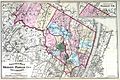 Bergen Passaic 1872.jpg 3,491 × 2,325; 1.48 MB
-
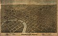
 Bird's eye view of the city of Charleston, South Carolina 1872. LOC 75696567.jpg 10,456 × 6,880; 20.13 MB
-
 Bird's eye view of the city of Charleston, South Carolina 1872. LOC 75696567.tif 10,456 × 6,880; 205.81 MB
-
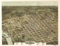
 Bird's eye view of the city of Columbia, South Carolina 1872. LOC 75696568.jpg 8,880 × 6,848; 14.2 MB
-
 Bird's eye view of the city of Columbia, South Carolina 1872. LOC 75696568.tif 8,880 × 6,848; 173.98 MB
-
 Bird's eye view of the city of Raleigh, North Carolina 1872. LOC 75694901.jpg 9,120 × 7,056; 18.27 MB
-
 Bird's eye view of the city of Raleigh, North Carolina 1872. LOC 75694901.tif 9,120 × 7,056; 184.11 MB
-

-

-
 Bird's-eye-view of Washington City, D.C. LOC 75693174.jpg 6,192 × 4,752; 4.88 MB
-
 Birds eye view of Columbus, Ohio LOC 84690606.jpg 11,360 × 7,064; 16.66 MB
-
 Buyeo 1872.png 1,476 × 1,959; 4.72 MB
-
 Cadastral map of block possibly in Washington D.C.. LOC 88693119.jpg 1,809 × 3,345; 591 KB
-
 Cadastral map of block possibly in Washington D.C.. LOC 88693119.tif 1,809 × 3,345; 17.31 MB
-
 Cadastral topographical map of part of N.W. Washington D.C.. LOC 88693473.jpg 10,571 × 13,663; 18.76 MB
-
 Cadastral topographical map of part of N.W. Washington D.C.. LOC 88693473.tif 10,571 × 13,663; 413.22 MB
-
 Carte de l'Autriche-Hongrie.jpg 1,362 × 1,024; 2.58 MB
-
 Carte nompatelize.jpg 1,113 × 1,771; 1.9 MB
-
 Cheoneulmyeon 1872.PNG 951 × 693; 1.46 MB
-
 Chepstow Place, Ordnance Survey map 1872.jpg 6,256 × 9,000; 21.12 MB
-
 China (östl. Theil), Korea und Japan im Massstab 1-7.500.000 LOC 2006629397.jpg 7,622 × 6,112; 8.64 MB
-
 China (östl. Theil), Korea und Japan im Massstab 1-7.500.000 LOC 2006629397.tif 7,622 × 6,112; 133.28 MB
-
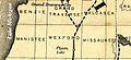 Clam Lake in Wexford County 1872.jpg 782 × 361; 91 KB
-
 Cochinchine 1872.png 1,887 × 1,260; 1.81 MB
-

-

-

-
 Copy Septr. 1879 (G.R.F) of map LOC 2005625194.jpg 7,729 × 6,629; 6.73 MB
-
 Copy Septr. 1879 (G.R.F) of map LOC 2005625194.tif 7,729 × 6,629; 146.59 MB
-
 Corals and coral islands (1872) (20078479823).jpg 4,280 × 2,276; 2.51 MB
-

-
 Diario di un viaggio in Arabia Petrea (1865) BHL48741116.jpg 2,268 × 2,872; 752 KB
-
 Die Gartenlaube (1872) b 215.jpg 1,152 × 1,768; 241 KB
-
 Dodge's Mount Desert Island LOC 99462701.jpg 4,442 × 4,305; 2.65 MB
-
 Dodge's Mount Desert Island LOC 99462701.tif 4,442 × 4,305; 54.71 MB
-
 Easter Island district map enhanced.jpg 1,536 × 1,266; 922 KB
-
 Easter Island district map.jpg 1,536 × 1,054; 527 KB
-
 Fifth Ward. NYPL1575884.tiff 6,108 × 5,376; 93.95 MB
-
 Fourth Ward. NYPL1575883.tiff 6,958 × 4,288; 85.36 MB
-
 From St. Christopher to Eustatius with Saba Island. (U. S. Hydrographic Chart. No. 369.) NYPL2020225.tiff 6,219 × 8,215, 2 pages; 146.23 MB
-
 Fullarton, A. & Co. Caucausus & Crimea. 1872 (B).jpg 2,412 × 1,836; 1.12 MB
-
 Fullarton, A. & Co. Caucausus & Crimea. 1872 (M).jpg 2,335 × 1,830; 1.03 MB
-
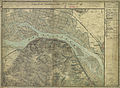
 Fullarton, French Ports & Harbours, and Plan of Paris, 1872 - David Rumsey.jpg 6,086 × 7,985; 10.53 MB
-
 Fullarton, Paris and its surrounding fortifications, 1872 - David Rumsey.jpg 4,676 × 3,760; 11.86 MB
-
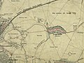
 Gelände der Sarg Werke in Liesing 1872.jpg 1,750 × 1,230; 2.87 MB
-
 German population 1872.jpg 948 × 1,155; 196 KB
-
 Gongju 1872.PNG 1,575 × 896; 3.08 MB
-
 Hand book and guide for the city of Newark, New Jersey (1872) (14773415351).jpg 3,284 × 3,012; 1.57 MB
-
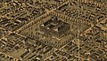
 Hannover aus der Vogelschau 1872.jpg 6,163 × 4,413; 9.82 MB
-
 Hoedeok 1872.png 1,345 × 960; 2.95 MB
-
 Itasca Lake Region by Julius Chambers.png 307 × 511; 27 KB
-
 Jefferson, Texas in 1872.jpg 7,052 × 5,602; 14.72 MB
-
 Jinjam 1972.PNG 1,637 × 962; 3.26 MB
-
 John Hugh Johnson, The Arctic Regions (FL37810214 3145241).jpg 8,268 × 11,549; 126.89 MB
-
 KarteEffretikonPfäffikonHinwiel.jpg 434 × 617; 151 KB
-
 LA3 1872 Floridsdorf.jpg 3,304 × 2,478; 4.94 MB
-
 LA3 1872 Grinzing.jpg 1,825 × 1,369; 1.72 MB
-
 LA3 1872 Leopoldau.jpg 3,661 × 2,746; 4.64 MB
-
 LA3 1872 Nussdorf.jpg 3,002 × 2,252; 4.59 MB
-
 LA3 1872 Stammersdorf.jpg 3,580 × 2,685; 4.98 MB
-
 LA3 1872 Strebersdorf.jpg 4,056 × 3,042; 7.42 MB
-
 Louis-Alphonse de Mandrot, Map of the Holy land (FL6883078 2639460).jpg 7,084 × 10,968; 119 MB
-
 Lübeck1872.jpg 1,272 × 868; 1.26 MB
-

-

-

-
-
-

-

-
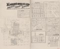
 Map of Pettis County, Missouri, 1872 LOC 2012593079.jpg 3,237 × 4,060; 2.58 MB
-
 Map of Polk County, Iowa LOC 2012587716.jpg 17,433 × 19,976; 44.34 MB
-
 Map of Rochester - from the latest surveys LOC 2011593643.jpg 6,195 × 8,775; 8.93 MB
-
 Map of Rochester - from the latest surveys LOC 2011593643.tif 6,195 × 8,775; 155.53 MB
-
 Map of Rose Point in Slippery Rock Township, 1872.png 414 × 277; 88 KB
-
 Map of the City of Buffalo, New York. NYPL1575875.tiff 5,428 × 6,154; 95.57 MB
-
 Map of the city of Lynn Massachusetts (3886418663).jpg 2,000 × 1,547; 2.88 MB
-

-
-
 Map of the town of Alexandria, Louisiana LOC 2004629015.jpg 16,462 × 7,867; 21.51 MB
-
 Map of the town of Alexandria, Louisiana LOC 2004629015.tif 16,462 × 7,867; 370.52 MB
-

-
 Map of Vermillion County, Indiana LOC 2013593167.jpg 7,596 × 17,973; 18.5 MB
-

-

-
 Map showing the Sodus Point & Southern Railroad and its connections. LOC 98688805.jpg 6,240 × 7,226; 10.76 MB
-
 Map showing the Sodus Point & Southern Railroad and its connections. LOC 98688805.tif 6,240 × 7,226; 129 MB
-

-
 Michigan, Minnesota, and Wisconsin. Walling, H. F.; Gray, Ormando Willis; Lloyd, H. H. 1872.jpg 5,809 × 4,249; 34.09 MB
-
 Military Reservation of Fort Seward.png 1,415 × 2,409; 3.32 MB
-
 Milwaukee 1872.jpg 11,952 × 8,416; 19.76 MB
-
 Milwaukee birdseye map by Bailey (1872). loc call no g4124m-pm010450.jpg 9,999 × 6,650; 13.61 MB
-
 Milwaukee, Wis. LOC 76693067.jpg 11,952 × 8,416; 20.6 MB
-
 Milwaukee, Wis. LOC 76693067.tif 11,952 × 8,416; 287.78 MB
-
 New commercial and topographical rail road map & guide of Missouri. LOC 98688504.jpg 7,368 × 5,184; 7.57 MB
-
 New commercial and topographical rail road map & guide of Missouri. LOC 98688504.tif 7,368 × 5,184; 109.28 MB
-
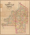
 New South Wales map of 19 counties 1872.jpg 5,000 × 4,158; 9.73 MB
-
 New York City Business Notices - List of Attorneys, Bankers etc NYPL1517299.tiff 6,299 × 4,592; 83.41 MB
-
 Old map-Dallas-1872.jpg 7,674 × 5,590; 11.85 MB
-
 Openpolar.jpg 1,800 × 1,394; 2.2 MB
-
 OS map Hampton 1872 004.jpg 2,427 × 3,485; 4.89 MB
-

-
 Plan Lyon 1872.jpg 10,602 × 7,936; 38.98 MB
-
 Plan Neusteinhof 1872.jpg 1,625 × 1,219; 1.86 MB
-
 Plan Neustift Inzersdorf 1872.jpg 1,575 × 1,181; 1.3 MB
-
 Plan of lands of Holbrook Land Co. at Holbrook 1872 (9472566595).jpg 800 × 360; 55 KB
-
 Preliminary map no.2 of the country surveyed in 1872 and 1873. LOC 98687121.jpg 6,832 × 8,456; 10.82 MB
-
 Preliminary map no.2 of the country surveyed in 1872 and 1873. LOC 98687121.tif 6,832 × 8,456; 165.29 MB
-
 PSM V02 D415 Weather chart.jpg 1,738 × 2,881; 1.84 MB
-
 Raleigh1872 BIG.jpg 1,750 × 1,336; 679 KB
-

-

-
 Rice's sectional map of Dakota Territory. LOC 2012593215.jpg 11,578 × 14,820; 17.27 MB
-
 Rice's sectional map of Dakota Territory. LOC 2012593215.tif 11,578 × 14,820; 490.91 MB
-
 Ripapa Island 1872 map.png 4,076 × 5,328; 26.36 MB
-
 Roughing It - 192.jpg 312 × 371; 30 KB
-
 Roxburgh NSW county map 1872.jpg 5,000 × 3,613; 9.11 MB
-
 Second Ward. NYPL1575881.tiff 6,958 × 4,242; 84.45 MB
-

-

-
 Soudan occidental-1872.jpg 760 × 567; 166 KB
-

-
-
-
 Square 18 - (Washington D.C.?) LOC 88693118.jpg 5,606 × 5,792; 2.69 MB
-
 Square 18 - (Washington D.C.?) LOC 88693118.tif 5,606 × 5,792; 92.9 MB
-
 Straube Neuester-Plan von Berlin 1872.jpg 5,621 × 5,532; 8.75 MB
-

-
 Table of Context NYPL1575868.tiff 5,134 × 6,442; 94.63 MB
-
 Tebenkov-sitka9.png 573 × 407; 207 KB
-
 Third Ward. NYPL1575882.tiff 6,940 × 3,878; 77 MB
-
 Thirteenth Ward. NYPL1575880.tiff 6,108 × 5,376; 93.95 MB
-

-
 Topographical map of Cape May Co., New Jersey - from recent and actual surveys LOC 2012592359.jpg 14,659 × 16,407; 36.38 MB
-
 Topographical map of Cape May Co., New Jersey - from recent and actual surveys LOC 2012592359.tif 14,659 × 16,407; 688.11 MB
-
 Topographical map of Ocean Co., New Jersey - from recent and actual surveys LOC 2012592356.jpg 15,976 × 21,609; 44.92 MB
-
 Wagenmann und Seybel 1872.jpg 1,484 × 1,068; 1.3 MB
-
 WE-Projekt.jpg 519 × 676; 374 KB
-

-


.jpg)
.jpg)
.jpg)

_p263_Map_of_a_portion_of_LAPLAND.jpg)
_p029_R%C3%B6mische_Anlagen_bei_VINDOBONA.jpg)
_p295_Wiens_Stadtentwicklung_bis_zum_Ende_des_15._Jahrhunderts.jpg)


.jpg)


_(16581160210).jpg)


,_Korea_und_Japan_im_Massstab_1-7.500.000_LOC_2006629397.jpg)


_of_map_LOC_2005625194.jpg)
_(20078479823).jpg)
_BHL48741116.jpg)
_b_215.jpg)


.jpg)
.jpg)


_(14773415351).jpg)


.jpg)


.jpg)


.jpg)


.jpg)

.jpg)


._loc_call_no_g4124m-pm010450.jpg)


.jpg)


.jpg)


.jpg)

_LOC_88693118.jpg)


_-_Unknown_-_20317096_-_RCE.jpg)


