Category:1871 maps of the United States
Jump to navigation
Jump to search
Countries of the Americas: Canada · United States of America
States of the United States: California · Illinois · Iowa · Kentucky · Massachusetts · Michigan · Minnesota · New York · Ohio · Pennsylvania · Texas · Wyoming
Subcategories
This category has the following 14 subcategories, out of 14 total.
C
- 1871 maps of California (4 F)
H
I
- 1871 maps of Illinois (13 F)
- 1871 maps of Iowa (6 F)
K
- 1871 maps of Kentucky (4 F)
M
- 1871 maps of Michigan (2 F)
- 1871 maps of Minnesota (3 F)
N
O
P
T
- 1871 maps of Texas (1 F)
W
- 1871 maps of Wyoming (6 F)
Media in category "1871 maps of the United States"
The following 15 files are in this category, out of 15 total.
-
 (Manuscript map of the United States). LOC 2019360436.jpg 11,183 × 8,011; 8.54 MB
-
 (Manuscript map of the United States). LOC 2019360436.tif 11,183 × 8,011; 256.31 MB
-
 (Manuscript school exercise maps of the United States) LOC 2018590111.jpg 9,290 × 5,220; 5.03 MB
-
 (Manuscript school exercise maps of the United States) LOC 2018590111.tif 9,290 × 5,220; 138.74 MB
-
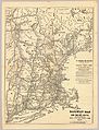 1871 New England railroad map.jpg 4,772 × 6,252; 6.68 MB
-
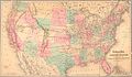
 Haasis & Lubrecht American Union Railroad Map 1871 UTA.jpg 2,526 × 1,824; 3.31 MB
-

-

-
 Map of the United States of America - btv1b530604871.jpg 22,957 × 15,399; 44.37 MB
-
-
 Lloyd's topographical map of America, 1871 (NYPL b20733340-5404019).jpg 9,658 × 7,556; 81.21 MB
-
 Lloyd's topographical map of America, 1871 (NYPL b20733340-5404019).tiff 10,328 × 7,760, 2 pages; 229.57 MB
-
 Lloyd's topographical map of America, 1871 (NYPL b20733340-5404020).jpg 9,642 × 7,386; 73.37 MB
-
 Lloyd's topographical map of America, 1871 (NYPL b20733340-5404020).tiff 10,328 × 7,760, 2 pages; 229.57 MB
-
 United States And Territories; Alaska NYPL1575778.tiff 7,038 × 5,124; 103.18 MB
._LOC_2019360436.jpg)
_LOC_2018590111.jpg)


.jpg)

.jpg)
.jpg)
.jpg)