Category:1861 maps of California
Jump to navigation
Jump to search
States of the United States: California · Delaware · Florida · Georgia · Illinois · Iowa · Louisiana · Maryland · Massachusetts · Michigan · Nevada · North Carolina · Ohio · South Carolina · Texas · Utah · Virginia · West Virginia – Washington, D.C.
| ← 1860 1861 1862 1864 1865 1866 1867 1868 1869 |
Media in category "1861 maps of California"
The following 5 files are in this category, out of 5 total.
-
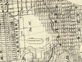 1861 Map of San Francisco, showing Pioneer Race Course.png 1,231 × 935; 2.45 MB
-
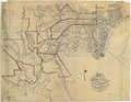
 City of San Francisco - 1861 - 001.jpg 7,803 × 6,208; 21.53 MB
-
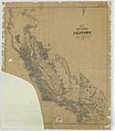 Map of Public Surveys in California to Accompany Report of Surveyor General - NARA - 23812176.jpg 10,272 × 11,797; 9.07 MB
-

-


.jpg)