Category:1856 maps
Jump to navigation
Jump to search
| ← · 1850 · 1851 · 1852 · 1853 · 1854 · 1855 · 1856 · 1857 · 1858 · 1859 · → |
Deutsch: Karten mit Bezug zum Jahr 1856
English: Maps related to the year 1856
Español: Mapas relativos al año 1856
Français : Cartes concernant l’an 1856
Русский: Карты 1856 года
Subcategories
This category has the following 11 subcategories, out of 11 total.
*
- 1856 maps of the world (2 F)
A
- 1856 maps of Africa (12 F)
E
G
M
- Map of Palást (1856) (6 F)
N
O
- 1856 maps of Oceania (empty)
S
- 1856 maps of South America (7 F)
Media in category "1856 maps"
The following 105 files are in this category, out of 105 total.
-
 Map of Crimea. George Dodd. Pictorial history of the Russian war 1854-5-6.jpg 6,177 × 9,486; 3.33 MB
-

-
 Fortress of SEVASTOPOL and adjacent country.jpg 5,888 × 4,284; 10.08 MB
-
 OLIPHANT(1856) p141 Plan of the Passage op the Ingour.jpg 3,345 × 2,107; 3.49 MB
-
 OLIPHANT(1856) p265 Map of the Transcaucasian Provinces.jpg 5,049 × 3,301; 10.24 MB
-

-

-

-

-

-
 1856 U.S. Coast Survey Map of Mobile Bay, Alabama - Geographicus - MobileBay-uscs-1856.jpg 3,753 × 5,000; 3.18 MB
-
 19th Century Penlow, Essex.png 355 × 231; 188 KB
-

-

-

-
 America Settentrionale E Meridionale, 1856.jpg 4,616 × 3,261; 2.63 MB
-

-
 Blatt 229 Hemhofen 1856 001.jpg 1,303 × 1,294; 611 KB
-
 Bulletin de la Société Impériale des Naturalistes de Moscou (1856) (20436342925).jpg 3,612 × 2,632; 1.08 MB
-
 Carlo Perrin, Pianta di Gerusalemme antica e moderna (FL6878237 2369856).jpg 2,100 × 2,942; 2.51 MB
-
 Carolinas1856.jpg 6,522 × 4,652; 2.61 MB
-

-

-

-
 Chapman's new sectional map of Minnesota. LOC 00555311.jpg 8,387 × 8,862; 7.79 MB
-
 Chapman's new sectional map of Minnesota. LOC 00555311.tif 8,387 × 8,862; 212.65 MB
-
-
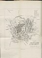
 Chattisham Map, Suffolk.png 948 × 642; 1.38 MB
-
-
 Copenhagen (1856).jpg 400 × 292; 53 KB
-
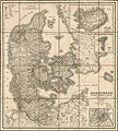 Daenmark mit seinen Nebenländern in Europa LOC 2015591082.jpg 6,771 × 7,541; 9.06 MB
-
 Daenmark mit seinen Nebenländern in Europa LOC 2015591082.tif 6,771 × 7,541; 146.08 MB
-

-
 Explorations in the Dacota country, in the year 1855 BHL32561791.jpg 3,101 × 3,730; 1.15 MB
-
 Explorations in the Dacota country, in the year 1855 BHL32561792.jpg 7,225 × 5,913; 4.76 MB
-
 First Series OS map showing Great Boughton and Chester in 1856.png 492 × 339; 497 KB
-

-

-

-

-

-
 John Seaton Warburton, Jerusalem (FL147425415 3756688).jpg 3,383 × 2,602; 7.02 MB
-
 Karl Andreas Stein, General Karte des Erzherzogthums Oesterreich 01-east-title (FL37099364 2529240).jpg 14,152 × 15,766; 347.45 MB
-
 Karl Andreas Stein, General Karte des Erzherzogthums Oesterreich 02-west (FL37099375 2529240).jpg 13,968 × 15,780; 357.98 MB
-
 The lands of the Saracen (IA landsofsaracen00tayl 0) (page 11 crop).jpg 1,679 × 2,505; 348 KB
-
 Louisiana map Colton 1856.jpg 1,607 × 1,285; 390 KB
-

-

-
 Map & profile of the Virginia & Tennessee Rail Road. LOC gm72003016.jpg 13,042 × 5,989; 10.95 MB
-
 Map & profile of the Virginia & Tennessee Rail Road. LOC gm72003016.tif 13,042 × 5,989; 223.47 MB
-

-
 Map of Crimea, 1856 (Halbinsel Krymm entworfen und gezeichnet von Major C. Radefeld).jpg 8,808 × 6,968; 11.37 MB
-
 Map of Eastern Kansas (5121144270).jpg 1,586 × 2,000; 2.76 MB
-

-
 Map of Kennebec Co., Maine LOC 2012592366.jpg 16,704 × 16,378; 40.24 MB
-
 Map of Russia.A. George Dodd. Pictorial history of the Russian war 1854-5-6.jpg 10,640 × 6,827; 5.24 MB
-
 Map of Russia.B. Caucasus. George Dodd. Pictorial history of the Russian war 1854-5-6.jpg 8,429 × 3,823; 1.93 MB
-

-

-

-

-

-

-

-

-

-

-
 Map of the Traditional Sinai (FL35469057 2369414).jpg 4,042 × 5,248; 30.67 MB
-

-

-

-
 Map of Windham County, Connecticut. LOC 2001620487.jpg 12,292 × 15,316; 31.05 MB
-
 Map of York County, Maine LOC 2011588007.jpg 15,835 × 17,061; 44.48 MB
-
 Map of York County, Maine LOC 2011588007.tif 15,835 × 17,061; 772.94 MB
-
 Map showing the location of the Charleston & Savannah R.R. May, 1856. LOC 98688615.jpg 10,409 × 6,544; 9.94 MB
-
 Map showing the location of the Charleston & Savannah R.R. May, 1856. LOC 98688615.tif 10,409 × 6,544; 194.88 MB
-
 Musashi no Kuni zenzu (14190273582).jpg 2,280 × 2,000; 2.08 MB
-
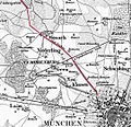 München–Dachau 1856.jpg 1,078 × 1,042; 531 KB
-
 NicaraguaMap1856.jpg 629 × 433; 545 KB
-
 Nørrevold (1856).jpg 1,325 × 1,600; 1 MB
-
 Palestine & adjacent countries (FL37821517 3923213).jpg 8,656 × 10,832; 128.16 MB
-
 Peninsula of Sinai (FL35469063 2369412).jpg 4,528 × 5,339; 33.31 MB
-
 Pettit's Historical Map of Seattle, 1913 (MOHAI 14551).jpg 1,000 × 628; 79 KB
-
 Plain of Esdraelon & Galilee (FL6880156 2369407).jpg 2,320 × 2,700; 3.69 MB
-
 Plan de la Jérusalem Hébraique et Chrétienne (FL6882350 2369556).jpg 2,100 × 2,815; 1.6 MB
-
 Plan of Chesnut Hill, in Brookline & Newton (5121138806).jpg 1,687 × 2,000; 2.75 MB
-

-

-
-
 Plan of Tyndall's buildings, Gray's Inn Lane. Wood engraving Wellcome V0020281ET.jpg 2,274 × 1,374; 1.84 MB
-
 Rail road map of the United States, showing the depots & stations. LOC 98688322.jpg 10,471 × 9,802; 15.94 MB
-

-
 Seperationsplan 1856 Wilmersdorf.jpeg 5,655 × 6,466; 10.39 MB
-
 Sistema idraulico.jpg 2,449 × 1,824; 5.08 MB
-
 Suez Bay, Egypt (Justus Perthes' Geographische Anstalt, 1856).jpg 1,510 × 1,278; 386 KB
-

-
 The Sea of Azoff. George Dodd. Pictorial history of the Russian war 1854-5-6.jpg 10,397 × 6,734; 4.15 MB
-
 Turkey in Asia and the Caucasian Provinces of Russia. J.H. Colton, 1856.jpg 2,046 × 1,700; 1.9 MB
-
 View fo the lake & north west-connections with Philadelphia. LOC 98688359.jpg 11,252 × 7,182; 12.51 MB
-

-

-

-
 Wind chart of the south and east coast of Africa RMG F0024.tiff 5,749 × 7,214; 118.66 MB
-
 Étienne Déchaud, Plan de Jerusalem du temps de N.S. Jesus-Christ (FL6880493 2369713).jpg 3,000 × 2,074; 1.78 MB
-
 Карта Северо-Кавказского Имамата на 27 мухаррама 1273 (1856 г.).jpg 4,112 × 3,464; 3.89 MB


_p141_Plan_of_the_Passage_op_the_Ingour.jpg)


_-_compiled_from_government_surveys_and_other_reliable_sources._LOC_2010593278.jpg)

_(18162164322).jpg)

_(20436342925).jpg)
.jpg)

.jpg)


.jpg)

_Bay_of_Burgas.jpg)
.jpg)


.jpg)
.jpg)
.jpg)

.jpg)
.jpg)
.jpg)
_(page_11_crop).jpg)


.jpg)
.jpg)


.jpg)


.jpg)

.jpg)


.jpg)


.jpg)
.jpg)
.jpg)
.jpg)
.jpg)
.jpg)
.jpg)
.jpg)


.jpg)


.jpg)
.jpg)
_p265_Map_of_the_Transcaucasian_Provinces.jpg)
.jpg)