Category:1855 maps of South America
Jump to navigation
Jump to search
Temperate regions: North America · South America · Africa · Europe · Asia · Oceania – Polar regions: – Other regions:
| ← 1850 1851 1852 1853 1854 1855 1856 1857 1858 1859 → |
Subcategories
This category has the following 2 subcategories, out of 2 total.
Media in category "1855 maps of South America"
The following 13 files are in this category, out of 13 total.
-

-

-

-
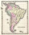 1855 Colton Map of South America - Geographicus - SouthAmerica-colton-1855.jpg 3,335 × 4,000; 4.04 MB
-
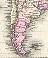
 1855 Map of Patagonia, Argentina (Falkland Islands) - Geographicus - Patagonia-cbl-1855.jpg 3,500 × 2,800; 1.82 MB
-

-
 Birds eye view of the pass of the interoceanic river aqueduct and valley of the Nerqua LOC 2009582496.tif 17,433 × 10,080; 502.75 MB
-

-
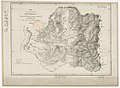
 Chile.1855.djvu 7,863 × 6,388; 4.74 MB
-
 Colton’s Peru and Bolivia WDL11317.png 1,170 × 1,024; 2.44 MB
-
-

-
 Patagonia, 1855.jpg 1,054 × 1,297; 513 KB


_-_Geographicus_-_Patagonia-cbl-1855.jpg)


.jpg)
