Category:1850s maps of the Near East
Jump to navigation
Jump to search
Media in category "1850s maps of the Near East"
The following 12 files are in this category, out of 12 total.
-

-
 1851 Henry Warren Map of Syria (cropped).jpg 3,162 × 4,413; 12.73 MB
-
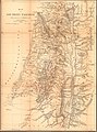
 Bible dictionary for the use of Bible classes, schools and families (1851) (14597207628).jpg 2,448 × 4,020; 1.95 MB
-
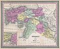
 Martin, R.M.; Tallis, J. & F. Turkey in Asia. 1851 (A).jpg 3,958 × 3,137; 3.66 MB
-
 Martin, R.M.; Tallis, J. & F. Turkey in Asia. 1851 (D).jpg 2,755 × 1,606; 1.45 MB
-
 Martin, R.M.; Tallis, J. & F. Turkey in Asia. 1851.jpg 4,700 × 3,750; 3.74 MB
-
-
 Die Asiatische Türkei, die Kaukasusländer und West-Persien von H. Kiepert.jpg 8,277 × 6,713; 20.61 MB
-
 1855 Colton Map of Turkey, Iraq, and Syria - Geographicus - TurkeyIraq-colton-1855.jpg 3,500 × 3,034; 3.22 MB
-
 Colton, G.W. Turkey In Asia And The Caucasian Provinces Of Russia. 1856 (A).jpg 4,858 × 4,206; 6.06 MB
-
 Colton, G.W. Turkey In Asia And The Caucasian Provinces Of Russia. 1856.jpg 5,970 × 5,650; 7.56 MB
-
 KiepertSouthernPalestine1856.jpg 4,522 × 6,119; 12.29 MB

.jpg)
_(14597207628).jpg)
.jpg)
.jpg)

_-_Geographicus_-_TurkeyAsia-mitchell-1850.jpg)


.jpg)

