Category:1840s maps of Denmark
Jump to navigation
Jump to search
Countries of Europe: Albania · Armenia‡ · Austria · Azerbaijan‡ · Belarus · Belgium · Bosnia and Herzegovina · Bulgaria · Croatia · Cyprus‡ · Czech Republic · Denmark · Finland · France‡ · Georgia‡ · Germany · Greece · Hungary · Republic of Ireland · Italy · Lithuania · Netherlands‡ · Norway · Poland · Portugal‡ · Romania · Russia‡ · Serbia · Slovakia · Slovenia · Spain‡ · Sweden · Switzerland · Turkey‡ · Ukraine · United Kingdom
Limited recognition: Abkhazia‡
‡: partly located in Europe
Limited recognition: Abkhazia‡
‡: partly located in Europe
Subcategories
This category has only the following subcategory.
C
Media in category "1840s maps of Denmark"
The following 10 files are in this category, out of 10 total.
-
-
 Dänemark Karte 1841 Friedrich Wilhelm Streit-2.jpg 3,262 × 3,807; 16.17 MB
-
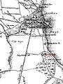 Marselisborg-kort.jpg 416 × 555; 77 KB
-
 Dänemark Karte 1847 Christian Gottfried Daniel Stein.jpg 8,855 × 11,555; 19.41 MB
-

-
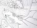 Hindgavl befæstningsanlæg 1848.jpg 690 × 518; 77 KB
-
 Karte von Dänemark und Mecklenburg Platt 1848.pdf 2,375 × 2,977; 933 KB
-

-
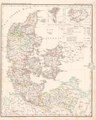
 Barclay's Dictionary Denmark.jpg 4,706 × 6,136; 21.89 MB
-
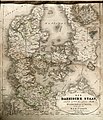
 Dänemark und die Herzogthümer Schleswig, Holstein u. Lauenburg.jpg 4,567 × 5,506; 6.44 MB
%27_(11017091705).jpg)


%27_(11026554255).jpg)


