Category:1830s maps of New York City
Jump to navigation
Jump to search
Media in category "1830s maps of New York City"
The following 7 files are in this category, out of 7 total.
-
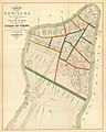 1831 Hooker Map of New York City (1871 reissue) - Geographicus - NewYork-hooker-1871.jpg 3,000 × 3,763; 2.6 MB
-
 1831 J. Langdon Pocket Map of New York City - Geographicus - NewYorkCity-langdon-1831.jpg 3,500 × 2,856; 2.85 MB
-
 1836 Colter Map with Bloomingdale neighborhood highlighted.jpg 2,600 × 1,271; 712 KB
-

-
 City of New-York. LOC 75692381.jpg 4,738 × 5,720; 3.91 MB
-
 New-York. NYPL433883.tiff 3,553 × 3,286; 33.41 MB
-

_-_Geographicus_-_NewYork-hooker-1871.jpg)


.jpg)

