Category:1827 maps of Europe
Jump to navigation
Jump to search
Temperate regions: North America · South America · Africa · Europe · Asia · Oceania – Polar regions: – Other regions:
English: 1827 maps of Europe
Español: Mapas de Europa en 1827
Suomi: Euroopan kartat vuodelta 1827
Română: Hărți ale Europei din 1827
Subcategories
This category has the following 8 subcategories, out of 8 total.
.
A
- 1827 maps of Austria (empty)
F
- 1827 maps of France (8 F)
G
N
- 1827 maps of Norway (13 F)
R
- 1827 maps of Russia (4 F)
S
- 1827 maps of Spain (1 F)
Media in category "1827 maps of Europe"
The following 8 files are in this category, out of 8 total.
-
 1827 Carte routière du Royaume des Pays-Bas, comprenant la Hollande et la Belgique.pdf 1,239 × 1,752, 2 pages; 3.02 MB
-
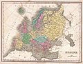 1827 Finley Map of Europe - Geographicus - Europe-finely-1827.jpg 3,000 × 2,335; 2.05 MB
-

-
 L'Europe avant l'invasion des barbares - par Fx Delamarche - btv1b8445409t.jpg 6,406 × 5,053; 4.94 MB
-

-
-
 Plano de Sevilla (1827).jpg 6,500 × 3,666; 4.43 MB
-


_where_Lithuanian_language_was_dominant_in_1827_(from_Atlas_statystyczny_Polski_i_krajow_okolicznych_by_Stanis%C5%82aw_Plater).jpg)
.jpg)
.jpg)
_-_btv1b53092996h.jpg)