Category:1810s maps of Palestine
Jump to navigation
Jump to search
Countries of Asia: Afghanistan · Armenia‡ · Azerbaijan‡ · People's Republic of China · Cyprus‡ · Egypt‡ · Georgia‡ · India · Indonesia‡ · Iran · Iraq · Japan · Lebanon · Pakistan · Philippines · Russia‡ · Syria · Turkey‡ · Turkmenistan
Limited recognition: Abkhazia‡ · Taiwan · State of Palestine
‡: partly located in Asia
Limited recognition: Abkhazia‡ · Taiwan · State of Palestine
‡: partly located in Asia
Media in category "1810s maps of Palestine"
The following 12 files are in this category, out of 12 total.
-
-
 Darton, William. Turkey in Asia. 1811 (DC).jpg 768 × 659; 142 KB
-
 Pinkerton, John. Turkey in Asia. 1813 (FA).jpg 479 × 469; 85 KB
-
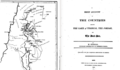
 Composite, A Sketch of the Countries between Jerusalem and Aleppo.jpg 7,830 × 11,810; 12.92 MB
-
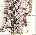
 John Melish. The Land of Moriah or Jerusalem and the Adjacent Country. 1815.jpg 4,287 × 5,479; 17.65 MB
-

-
-

-

-
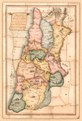
 Jacotin's 1799 survey, extract showing Palestine.png 2,983 × 6,576; 35.73 MB
-

-


.jpg)
.jpg)


.jpg)
.png)


