Category:1800s maps of the Near East
Jump to navigation
Jump to search
Subcategories
This category has only the following subcategory.
1
Media in category "1800s maps of the Near East"
The following 6 files are in this category, out of 6 total.
-
 1801 map of Turkey in Asia by John Cary.jpg 13,895 × 12,545; 25.59 MB
-
 Cary, John, ca. Turkey in Asia. 1801 (A).jpg 3,675 × 3,276; 3.39 MB
-
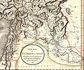 Cary, John, ca. Turkey in Asia. 1801 (H).jpg 2,296 × 1,897; 1.27 MB
-
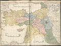 Cedid Atlas (Middle East) 1803.jpg 10,840 × 8,199; 18.62 MB
-
 1808 map of Turkey in Asia (cropped).jpg 5,633 × 4,244; 17.26 MB
-
 1808 map of Turkey in Asia.jpg 7,025 × 5,841; 30.62 MB

.jpg)
.jpg)
_1803.jpg)
.jpg)
