Category:17th-century maps of the Middle East
Jump to navigation
Jump to search
Subcategories
This category has only the following subcategory.
1
Media in category "17th-century maps of the Middle East"
The following 9 files are in this category, out of 9 total.
-
 Geographia Sacra.jpg 12,797 × 10,083; 24.34 MB
-

-
-
 Map of Arabia, in Olfert Dapper Wellcome L0011010.jpg 1,482 × 1,290; 984 KB
-
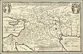
 Nova Persiae Armeniae Natoliae et Arabiae (8342790665).jpg 800 × 652; 167 KB
-

-
 Map of Armenia, Description de L'Universe (Alain Manesson Mallet, 1683).jpg 725 × 1,078; 162 KB
-
 Ca. 1690 Dutch, biblical map of the Middle East.jpg 11,038 × 7,473; 17.07 MB
-
 Ca. 1690 biblical map of the Middle East.jpg 11,219 × 8,658; 20.73 MB

.jpg)


.jpg)
.jpg)
.jpg)

