Category:17th-century maps of Italy
Jump to navigation
Jump to search
Countries of Europe: Albania · Armenia‡ · Austria · Azerbaijan‡ · Belarus · Belgium · Bosnia and Herzegovina · Bulgaria · Croatia · Cyprus‡ · Czech Republic · Denmark · Estonia · Finland · France‡ · Georgia‡ · Germany · Greece · Hungary · Iceland · Republic of Ireland · Italy · Latvia · Lithuania · Luxembourg · Malta · Montenegro · Netherlands‡ · Norway · Poland · Portugal‡ · Romania · Russia‡ · Serbia · Slovakia · Slovenia · Spain‡ · Sweden · Switzerland · Turkey‡ · Ukraine · United Kingdom
Specific status: Isle of Man – Limited recognition: Abkhazia‡
‡: partly located in Europe
Specific status: Isle of Man – Limited recognition: Abkhazia‡
‡: partly located in Europe
Subcategories
This category has the following 26 subcategories, out of 26 total.
Media in category "17th-century maps of Italy"
The following 36 files are in this category, out of 36 total.
-
 Print, map (BM 1979,U.677).jpg 2,216 × 2,500; 1.47 MB
-
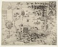 Map of the siege of the Gradisca fortress, 1616.jpg 2,802 × 2,264; 1.58 MB
-
 Atlas ou Representation du Monde Universel t. 2. 1633 (110102041).jpg 17,151 × 12,004; 36.1 MB
-
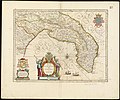
 08 - Ducato di Urbino, 1635 - Henricus Hondius, Jan Jansson.jpg 2,827 × 2,207; 1.35 MB
-

-
 Territorio di Bologna - btv1b53043077h (1 of 2).jpg 7,888 × 6,091; 9.47 MB
-
 A209113 0405 - 52377221447.jpg 5,641 × 4,555; 6.79 MB
-
 Brindisi, 1618 RCIN 721135.jpg 2,250 × 1,682; 1.62 MB
-
 Campagna di Roma (8342170905).jpg 800 × 665; 131 KB
-
 Capitanata, olim Mesapiae et Iapygiae pars (8342170631).jpg 800 × 667; 133 KB
-
 Cremona nel 17esimo secolo.jpg 863 × 600; 263 KB
-
 Disegno di palazzo Perolari Malmignati.jpg 4,608 × 3,456; 5.11 MB
-
 Dissegno della rocca et castello d Arzignano map 17th century.jpg 1,020 × 702; 186 KB
-
 Ducato di Ferrara (8342170795) (cropped).jpg 926 × 1,234; 1.47 MB
-
 Ducato di Ferrara (8342170795).jpg 6,684 × 5,571; 36.06 MB
-

-
 Jan Jansson - Ducato di Modena Regio et Carpi col dominio della Carfagnana.jpg 2,002 × 1,660; 3.91 MB
-
 Kaart van Noord-Italië, objectnr A 16248.jpg 12,164 × 11,062; 94.16 MB
-
 Map of ancient northern Italy, 1683.jpg 718 × 1,036; 172 KB
-
 Map of ancient southern Italy, 1685.jpg 635 × 900; 407 KB
-
 Map of Italy by Abraham Ortelius.jpeg 1,564 × 1,184; 587 KB
-
 Map of Italy, 1685.jpg 637 × 900; 405 KB
-
 Map of Naples, 1685.jpg 649 × 900; 423 KB
-
 Map of Sardinia, 1685.jpg 617 × 900; 481 KB
-
 Map of Sicily, 1685.jpg 654 × 900; 439 KB
-
 Map of the papal state and Tuscany, 1683.jpg 600 × 832; 216 KB
-
 Map of Venice, 1685.jpg 648 × 900; 402 KB
-
 Mappa della Romagna nel 17esimo secolo.jpg 815 × 600; 214 KB
-
 Mura della città di Vicenza Dall Acqua map 17th century.jpg 825 × 586; 89 KB
-
 Percorso Scortico tratto dalla mappa Polesino di Rovigo.jpg 733 × 549; 104 KB
-
 Salvator Oliva. Mediterranean. HM 2515. PORTOLAN ATLAS. Marseilles, 1619.B.jpg 2,330 × 2,215; 1.68 MB
-
 Terra di Bari et Basilicata (8343227726).jpg 800 × 669; 131 KB
-
 Terra di Otranto olim Salentina et Iapigia (8342170451).jpg 800 × 666; 127 KB
-
 Territorio di Orvieto - Fabio di Gio Antonio Magini - btv1b530426815.jpg 6,025 × 4,949; 4.82 MB
-
 Territorio di Orvieto - Fabio di Gio. Ant. Magini - btv1b53042279t (1 of 2).jpg 4,986 × 4,435; 4.01 MB
-
 Territorio Perugino (8343657890).jpg 800 × 660; 130 KB
.jpg)

.jpg)

.jpg)
.jpg)


.jpg)
.jpg)


_(cropped).jpg)
.jpg)
.jpg)


.jpg)
.jpg)

.jpg)
.jpg)