Category:17th-century maps of Boston
Jump to navigation
Jump to search
Maps of Boston by century: (BCE) (CE) 17th century · 18th century · 19th century · 20th century · 21st century ·
Subcategories
This category has the following 2 subcategories, out of 2 total.
O
- Old Boston by George Lamb (2 F)
Media in category "17th-century maps of Boston"
The following 16 files are in this category, out of 16 total.
-

-
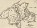
 1630 Boston byGeorgeLamb.png 828 × 627; 659 KB
-
 1630s FinancialDistrict Boston byWilliamAppleton.png 814 × 713; 913 KB
-
 1630s NorthEnd Boston byWilliamAppleton.png 811 × 715; 813 KB
-
 1635 BendellsCove Boston map byGeorgeLamb.png 810 × 708; 1.17 MB
-
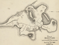
 1645 Boston byGeorgeLamb.png 880 × 666; 1,006 KB
-
 1693 Boston byFranquelin.png 827 × 644; 998 KB
-
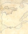
 1693 Boston map Hydrog.png 736 × 480; 151 KB
-
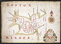 Fitzhugh, Boston Harbor.jpg 1,096 × 800; 1.47 MB
-
 17thcMap CourtSt SchoolSt Boston Drake1917.png 306 × 539; 47 KB
-
 A draught of Boston Harbor by Capt. Cyprian Southake (3120131115).jpg 2,000 × 1,609; 2.78 MB
-
 Boston 1630 1675.jpg 1,566 × 1,450; 648 KB
-
 Boston1692.jpg 1,024 × 1,271; 487 KB
-
 BostonNeck.jpg 600 × 616; 408 KB
-
 This harbour of Boston (2674783843).jpg 1,537 × 2,000; 1.85 MB
-

_(14783592658).jpg)


.jpg)


.jpg)
