Category:1780s maps of the United States
Jump to navigation
Jump to search

States of the United States: Alabama · Alaska · Arkansas · California · Connecticut · Delaware · Florida · Georgia · Illinois · Indiana · Kentucky · Louisiana · Maryland · Massachusetts · Michigan · Mississippi · Missouri · Montana · New Hampshire · New Jersey · New York · North Carolina · North Dakota · Ohio · Pennsylvania · Rhode Island · South Carolina · Vermont · Virginia · Wisconsin – Washington, D.C.
Puerto Rico
Puerto Rico
Subcategories
This category has the following 43 subcategories, out of 43 total.
- 1783 maps of the United States (37 F)
A
- 1780s maps of Alaska (3 F)
- 1780s maps of Arkansas (2 F)
C
- 1780s maps of Connecticut (2 F)
D
- 1780s maps of Delaware (7 F)
F
G
I
- 1780s maps of Indiana (2 F)
K
L
M
- Maps of the Northwest Indian War (18 F)
- 1780s maps of Maryland (7 F)
- 1780s maps of Mississippi (5 F)
- 1780s maps of Missouri (4 F)
N
- 1780s maps of North Carolina (3 F)
O
P
R
- 1780s maps of Rhode Island (2 F)
S
- 1780s maps of South Carolina (4 F)
V
- 1780s maps of Vermont (4 F)
W
Media in category "1780s maps of the United States"
The following 4 files are in this category, out of 4 total.
-
 Forthenrymap.jpg 705 × 1,024; 291 KB
-
 Notes on Virginia (1787) - map.png 6,974 × 7,025; 2.37 MB
-
 NW Native Tribes, 1792.png 884 × 860; 153 KB
-
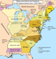 United States land claims and cessions 1782-1802.png 747 × 782; 145 KB

_-_map.png)

