Category:1770s maps of Lithuania
Jump to navigation
Jump to search
Countries of Europe: Albania · Armenia‡ · Azerbaijan‡ · Belgium · Cyprus‡ · Denmark · France‡ · Georgia‡ · Germany · Greece · Republic of Ireland · Italy · Lithuania · Moldova · Montenegro · Netherlands‡ · Norway · Poland · Portugal‡ · Romania · Russia‡ · Serbia · Spain‡ · Sweden · Switzerland · Turkey‡ · Ukraine · United Kingdom
Limited recognition: Abkhazia‡
‡: partly located in Europe
Limited recognition: Abkhazia‡
‡: partly located in Europe
Subcategories
This category has the following 2 subcategories, out of 2 total.
- 1778 maps of Lithuania (1 F)
Media in category "1770s maps of Lithuania"
The following 9 files are in this category, out of 9 total.
-
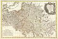
 MAP-Polish-Lithuanian-Commonwealth-1770-Reduced.jpg 1,948 × 1,253; 2.98 MB
-
 Vialikaje Kniastva Litoŭskaje. Вялікае Княства Літоўскае (T. Lotter, 1770).jpg 3,223 × 2,724; 3.3 MB
-
 1771 Zannoni Map of Poland and Lithuania - Geographicus - Poland-zannoni-1771.jpg 3,000 × 2,025; 2.11 MB
-

-
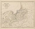 Toeppen Preussen 1772.jpg 6,700 × 5,526; 4.03 MB
-
 Vilnia-Połacak-Viciebsk. Вільня-Полацак-Віцебск (1772) (2).jpg 12,892 × 9,315; 19.31 MB
-
 Vilnia-Połacak-Viciebsk. Вільня-Полацак-Віцебск (1772).jpg 6,848 × 4,659; 19.76 MB
-
 Grand Duchy of Lithuania WDL143.png 1,174 × 1,024; 2.68 MB
-


.jpg)


_(2).jpg)
.jpg)

