Category:1760s maps of Portugal
Jump to navigation
Jump to search
Countries of Europe: Albania · Armenia‡ · Austria · Azerbaijan‡ · Belgium · Bosnia and Herzegovina · Bulgaria · Cyprus‡ · Denmark · France‡ · Georgia‡ · Germany · Greece · Hungary · Republic of Ireland · Italy · Lithuania · Moldova · Montenegro · Netherlands‡ · Norway · Poland · Portugal‡ · Romania · Russia‡ · Slovenia · Spain‡ · Sweden · Switzerland · Turkey‡ · Ukraine · United Kingdom
Limited recognition: Abkhazia‡
‡: partly located in Europe
Limited recognition: Abkhazia‡
‡: partly located in Europe
Media in category "1760s maps of Portugal"
The following 18 files are in this category, out of 18 total.
-
 Ar.Gbis-T.6-C.2 84.jpg 3,397 × 2,480; 1.61 MB
-
-
-

-
 Jeu des cartes géographiques - S. L. Hegrad (27) - Le Portugal.jpg 1,591 × 2,776; 501 KB
-
 Situação geográfica de Olivença (1766).jpg 1,752 × 1,178; 1.46 MB
-
 Olivenza1766.jpg 1,331 × 996; 575 KB
-

-
 A Província de Trás-os-Montes em 1762.jpg 1,584 × 1,111; 397 KB
-

-

-

-
-

-

-
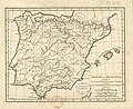
 Les Royaumes d’Espagne et de Portugal divisés par grandes provinces.jpg 1,868 × 1,300; 1.17 MB
-
 Mappa ou carta geographica dos reinos de Portugal et Alzarve - por T. Jefferys... - btv1b53239390n.jpg 11,660 × 20,664; 45.36 MB
-


.jpg)
.jpg)
.jpg)
_-_Le_Portugal.jpg)
.jpg)

m_Burgis_-_btv1b53056198h.jpg)


