Category:1760 maps of France
Jump to navigation
Jump to search
Subcategories
This category has the following 4 subcategories, out of 4 total.
Media in category "1760 maps of France"
The following 5 files are in this category, out of 5 total.
-
 1760 - Echelle en perches.jpg 5,808 × 1,944; 4.43 MB
-
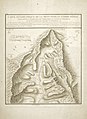 Carte géométrique de la Montagne et Combe d’Olle.jpg 3,333 × 4,566; 11.6 MB
-

-

-


