Category:1740s maps of Belgium
Jump to navigation
Jump to search
Countries of Europe: Albania · Armenia‡ · Austria · Azerbaijan‡ · Belarus · Belgium · Bosnia and Herzegovina · Bulgaria · Croatia · Cyprus‡ · Czech Republic · Denmark · France‡ · Georgia‡ · Germany · Greece · Republic of Ireland · Italy · Lithuania · Netherlands‡ · Norway · Poland · Portugal‡ · Romania · Russia‡ · Serbia · Slovenia · Spain‡ · Sweden · Switzerland · Turkey‡ · Ukraine · United Kingdom
Limited recognition: Abkhazia‡
‡: partly located in Europe
Limited recognition: Abkhazia‡
‡: partly located in Europe
Subcategories
This category has the following 2 subcategories, out of 2 total.
- 1746 maps of Belgium (4 F)
- 1747 maps of Belgium (6 F)
Media in category "1740s maps of Belgium"
The following 13 files are in this category, out of 13 total.
-

-

-
 Lahamaide Villaretkaart 1745.png 1,063 × 622; 982 KB
-
 A Map of the Netherlands or Low Countries in 1713 by Emanuel Bowen.jpg 1,753 × 1,643; 756 KB
-
 Tobiasmayerbelgium.jpg 1,732 × 1,513; 3.83 MB
-
 1748 Leo Schenk.jpg 640 × 504; 151 KB
-
 Septem Provinciae seu Belgium Foederatum 1748.jpg 7,726 × 6,770; 15.87 MB
-
 Uittreksel Villaret-kaart (1745-1748).png 297 × 363; 309 KB
-
 Attaques d'Ath en 1745 - btv1b55003302r (1 of 2).jpg 5,163 × 3,920; 1.35 MB
-
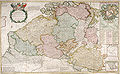 Herman Moll Map of Belgium.jpg 760 × 470; 192 KB
-
 Pauselijkezouaaf op villaretkaart.png 1,337 × 690; 1.87 MB
-
 Ten Bulcke - Villaretkaart (1745).png 1,048 × 559; 1 MB
-
 Wambeek villaret.png 608 × 538; 741 KB
.jpg)
,_RP-P-AO-19B-39.jpg)


.png)
.jpg)


.png)
