Category:1700s maps of Iran
Jump to navigation
Jump to search
Countries of Asia: Armenia‡ · Azerbaijan‡ · People's Republic of China · Egypt‡ · Georgia‡ · India · Indonesia‡ · Iran · Iraq · Japan · Philippines · Russia‡ · Syria · Turkey‡
Limited recognition: Taiwan · State of Palestine
‡: partly located in Asia
Limited recognition: Taiwan · State of Palestine
‡: partly located in Asia
Media in category "1700s maps of Iran"
The following 6 files are in this category, out of 6 total.
-
 A large draught of the golf of Persia - btv1b8593032p.jpg 9,249 × 7,262; 9.87 MB
-
 1701 Guillaume Delisle map of the Ottoman and Persian Empires (cropped).jpg 8,875 × 6,466; 50.25 MB
-
 1701 map - Carte De La Turquie De L'Arabie et De La Perse.jpg 16,291 × 12,420; 37.51 MB
-
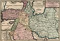 La Perse la Georgie et la Turquie d'Asie, by Nicolas de Fer.jpg 9,176 × 6,208; 11.84 MB
-

-


.jpg)


