Category:1700s maps of Europe
Jump to navigation
Jump to search
Temperate regions: North America · South America · Africa · Europe · Asia · Oceania – Polar regions: – Other regions:
Subcategories
This category has the following 40 subcategories, out of 40 total.
.
A
- 1700s maps of Austria (10 F)
B
C
D
E
F
G
- 1700s maps of Georgia (2 F)
H
I
L
N
P
- 1700s maps of Portugal (41 F)
R
S
- 1700s maps of Slovenia (12 F)
- 1700s maps of Switzerland (9 F)
T
U
Media in category "1700s maps of Europe"
The following 6 files are in this category, out of 6 total.
-
 A chart of the EAST-SEA NYPL1640726.tiff 7,230 × 5,428; 112.28 MB
-
 A large draught of the Isle of Orkney and Shetland with the north part of SCOTLAND. NYPL1640561.tiff 11,310 × 5,400; 174.76 MB
-
 Accuratissima Europae tabula - CBT 6625493.jpg 5,612 × 4,738; 8.53 MB
-
 Europa excultissima - CBT 5871228.jpg 5,588 × 4,738; 9.49 MB
-
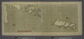
 Moray Firth and Sutherland, Scotland) NYPL1640564.tiff 7,230 × 5,428; 112.28 MB
-
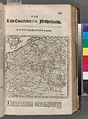 The Spanish Netherlands (NYPL b15373374-1505126).jpg 4,640 × 6,299; 7.16 MB


.jpg)