Category:16th-century maps of the Arctic
Jump to navigation
Jump to search
Subcategories
This category has only the following subcategory.
M
Media in category "16th-century maps of the Arctic"
The following 24 files are in this category, out of 24 total.
-
 Detail of world map - Artic with magnetic island as North Pole.jpg 1,918 × 1,972; 1.19 MB
-
 1598 map of the Polar Regions by Willem Barentsz.jpg 13,719 × 10,160; 30.66 MB
-
 VEER(1873) p057 Map of the Barents-Expedition in1596-97.jpg 4,919 × 2,890; 3.45 MB
-
 Aankomst van de zeven schepen bij de straat Waygats, 1595, NG-1979-564-9.jpg 3,574 × 4,150; 2.71 MB
-
 Aankomst van de zeven schepen bij de straat Waygats, 1595, RP-P-OB-80.202.jpg 5,016 × 3,952; 2.39 MB
-
 Barents third voyage.jpg 2,000 × 1,511; 965 KB
-
 Barentskartet, 1598 (12068020364).jpg 2,842 × 2,091; 3.85 MB
-
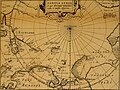
 Barentsz arctic map.jpg 650 × 517; 102 KB
-
 Barentsz Full Map.jpg 1,000 × 742; 258 KB
-
 Forminsket utgave av Barentskartet - no-nb krt 00487.jpg 4,418 × 3,449; 3.45 MB
-

-
 Kaart van de Russische kust met het plaatsje Kola, 1597, RP-P-OB-80.227.jpg 6,132 × 4,862; 5.05 MB
-

-
 Kaart van Nova Zembla, 1594, NG-1979-564-2.jpg 3,502 × 4,144; 2.66 MB
-
 Kaart van Nova Zembla, 1594, RP-P-OB-80.197.jpg 4,840 × 3,940; 2.05 MB
-

-
 Kaartje van de rivermond met het plaatsje Kola, 1597, RP-P-OB-80.228.jpg 6,172 × 4,930; 5.22 MB
-

-

-

-

-

-
 Pontanus 1611 Arctic Map.jpg 2,852 × 2,142; 802 KB
-
 Terre Arctiques, NG-1983-2.jpg 4,148 × 6,022; 2.76 MB


_p057_Map_of_the_Barents-Expedition_in1596-97.jpg)


.jpg)


_door_Willem_Barendsz_(titel_op_object),_NG-800.jpg)


_(titel_op_object),_NG-501-45.jpg)

,_RP-P-OB-80.196.jpg)
,_RP-P-OB-80.229.jpg)
,_RP-P-OB-44.071.jpg)
,_RP-P-1896-A-19368-2996.jpg)
,_RP-P-1896-A-19368-3035.jpg)

