Category:1660s maps of the world
Jump to navigation
Jump to search
| 17th-century maps of the world: ← 1600s 1610s 1620s 1630s 1640s 1650s 1660s 1670s 1680s 1690s → |
English: This category is supposed to hold world maps created in the 1660s.
Subcategories
This category has only the following subcategory.
1
Media in category "1660s maps of the world"
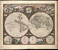
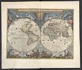
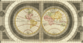
The following 39 files are in this category, out of 39 total.
-

-
 (Nova et accuratissima totius terrarum orbis tabula). LOC 98687202.jpg 6,782 × 5,130; 8.36 MB
-
 (Nova et accuratissima totius terrarum orbis tabula). LOC 98687202.tif 6,782 × 5,130; 99.54 MB
-
 1660 celestial map - Scenographia Systematis Mundani Ptolemaici.jpg 13,701 × 11,756; 36.7 MB
-
 1660 geocentric model chart - Scenographia Systematis Mundani Ptolemaici.jpg 13,036 × 11,158; 33.88 MB
-
 1660 Nova Totius de Wit 12 bladige wandkaart.jpg 3,584 × 2,752; 2.09 MB
-
 Continentem Dudum Notam Componebat (with) Continentem Noviter Detectam, 1660.jpg 5,087 × 3,164; 4.53 MB
-

-
 Nova totius terrarum orbis tabula auctore F. de Wit RMG F8117.tiff 4,800 × 3,722; 51.11 MB
-
 1660 engraving Scenographia Systematis Copernicani.jpg 783 × 700; 449 KB
-
 Nova Orbis Tabula in Lucem Edita.jpg 2,172 × 1,820; 888 KB
-
 Johannes Blaeu - World map 1664.jpg 877 × 650; 197 KB
-
 Nova et Accuratissima Terrarum Orbis Tabula (J.Blaeu, 1664).jpg 7,686 × 6,751; 15.76 MB
-
 Nuevo Atlas o Teatro Mundo - Nova et Accuratissima Totius.jpg 6,480 × 5,144; 5.43 MB
-
 Nova totius terrarum orbis tabula (8429816765).jpg 800 × 678; 170 KB
-

-
 1666 Orbis Terrarum Goos.jpg 4,782 × 3,702; 9.92 MB
-
 Le Globe Terrestre - Par P. Du Val Geographe du Roy - btv1b550003804 (1 of 2).jpg 3,750 × 5,498; 1.98 MB
-
 Le Globe Terrestre - Par P. Du Val Geographe du Roy - btv1b550003804 (2 of 2).jpg 3,664 × 5,488; 1.31 MB
-
 Le globe terrestre - par P. Du Val... - btv1b8444042r (1 of 2).jpg 4,934 × 7,739; 5.03 MB
-
 Le globe terrestre - par P. Du Val... - btv1b8444042r (2 of 2).jpg 5,185 × 8,024; 5.24 MB
-
-
 Pierre Duval, Planisphere ou carte generale du monde (FL13730376 2718552).jpg 9,800 × 7,156; 102.68 MB
-
 1669 map of the world by Pieter Goos.tif 6,927 × 5,900; 233.88 MB
-
 1664 Nova et Accvrat Blaeu.jpg 874 × 659; 575 KB
-
 De Grondt en Vloer vande Groote Burger Sael.jpg 17,972 × 10,455; 57.1 MB
-
 Great Burgerzaal Map and Celestial Map.jpg 13,520 × 3,961; 19.4 MB
-
 Great Burgerzaal Map.png 2,321 × 1,200; 7.63 MB
-
 Les tables de geographie, reduites en un jeu de cartes (35015059592).jpg 2,000 × 1,558; 3.36 MB
-
 Map - Special Collections University of Amsterdam - OTM- HB-KZL 31-01-11.tif 6,686 × 3,680; 70.39 MB
-
-

-
 Nova delineatio totius orbis terrarum RMG F8090.tiff 4,741 × 4,168; 56.54 MB
-
-
-
 Nieuwe Werelt kaert (NYPL b13647135-ps map cd7 081).jpg 4,072 × 4,072; 6.54 MB
-

-
 Weltkarte Atlas Blaeuw.jpg 11,220 × 8,524; 42.03 MB
-

.jpg)
._LOC_98687202.jpg)


_Continentem_Noviter_Detectam,_1660.jpg)


.jpg)

.jpg)
_-_Geographicus_-_GeoHydro-kircher-1665.jpg)

.jpg)
.jpg)
.jpg)
.jpg)
.1.(1).jpg)
.jpg)


.jpg)

_Amsterdam_Gedruckt_by_Iustus_Danckers_consien_caert_vercoper_inde_Calverstaet_nule_Danckbaenheyt._RMG_RP6726.jpg)
.jpg)
,_RP-P-AO-21-13-15.jpg)

,_RP-P-1891-A-16621.jpg)