Category:1580s maps of Greece
Jump to navigation
Jump to search
Countries of Europe: Austria · Belgium · Bosnia and Herzegovina · Bulgaria · Croatia · Finland · France‡ · Germany · Greece · Hungary · Italy · Lithuania · Netherlands‡ · Norway · Poland · Portugal‡ · Romania · Russia‡ · Slovenia · Spain‡ · Turkey‡ · Ukraine
‡: partly located in Europe
‡: partly located in Europe
Subcategories
This category has only the following subcategory.
1
Media in category "1580s maps of Greece"
The following 6 files are in this category, out of 6 total.
-
 1584 map of Greece and the Aegean Sea by Abraham Ortelius.jpg 12,895 × 9,347; 29.09 MB
-
 1584 map of Greece and Western Turkey by Abraham Ortelius.jpg 12,525 × 9,061; 26.74 MB
-
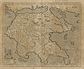
 1584 map of Greece by Abraham Ortelius.jpg 12,729 × 9,188; 32.66 MB
-

-
 Thraciae-veteris-typvs.jpg 4,452 × 3,424; 3.59 MB
-
 Morea olim Peloponnesus - per Gerardum Mercatorem - btv1b53033694z (1 of 2).jpg 5,230 × 4,307; 4.33 MB


_and_10_Greek_Islands_-_Geographicus_-_CandiaInsula-ortelius-1584.jpg)

.jpg)